Area Overview for B94 5QW
Photos of B94 5QW

Area Information
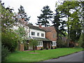
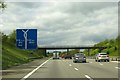
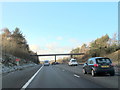
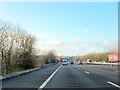
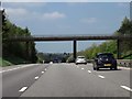
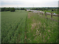
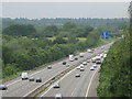
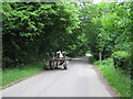
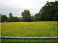
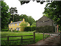
Living in B94 5QW means being part of a small, tightly knit residential cluster in Lapworth, Warwickshire. The area has a population of 1,652, spread across 78 people per square kilometre, reflecting its quiet, village-like character. Situated 5 km north of Henley-in-Arden and near junction 16 of the M40 motorway, it balances rural tranquillity with easy access to nearby towns like Solihull and Warwick. Historically remote, with Anglo-Saxon origins, the area retains a sense of heritage, bordered by the A3400 and the Grand Union Canal. Daily life here is shaped by its proximity to nature, with nearby National Trust sites such as Baddesley Clinton and Packwood House offering historical and scenic value. The settlement’s population is concentrated in Kingswood, near Lapworth railway station, making it a practical base for commuters while maintaining a low-key, community-focused vibe.
- Area Type
- Postcode
- Area Size
- Not available
- Population
- 1652
- Population Density
- 78 people/km²
The property market in B94 5QW is characterised by high home ownership (74%) and a focus on houses rather than flats or apartments. This suggests a market dominated by owner-occupied properties, with limited rental activity. The small size of the area means the housing stock is likely limited, with few new developments. For buyers, this implies a need to look beyond the immediate postcode to surrounding villages for more options. The prevalence of houses indicates a preference for spacious, private living, which may appeal to families or those seeking a semi-rural lifestyle. However, the small population and low density mean competition for properties could be minimal, though buyers should consider proximity to amenities and transport links when evaluating the area’s appeal.
House Prices in B94 5QW
No properties found in this postcode.
Energy Efficiency in B94 5QW
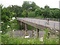
Life in B94 5QW combines rural charm with practical amenities. Within reach are five railway stations, including Lapworth and Dorridge, offering connections to regional hubs. Retail options include Sainsburys Dorridge and Tesco Dorridge, providing everyday shopping needs. The area’s historical roots are evident in nearby sites like Baddesley Clinton and Packwood House, offering cultural and recreational opportunities. The Grand Union Canal and surrounding countryside provide scenic walking and cycling routes. While local dining and entertainment options are limited, the proximity to larger towns ensures access to a wider range of facilities. The mix of natural beauty and practical connectivity creates a balanced lifestyle, appealing to those seeking tranquillity without sacrificing convenience.
Amenities
Schools
The nearest school to B94 5QW is Lapworth CofE Primary School, which serves the local community with a good Ofsted rating. This school is a key consideration for families with young children, offering a solid foundation for primary education. The absence of secondary schools in the immediate area means students may need to travel to nearby towns like Solihull or Warwick for further education. The presence of a well-rated primary school enhances the area’s appeal for families, though parents should factor in commuting times for older children. The school’s rating reflects a commitment to quality education, which aligns with the area’s overall emphasis on stability and community-focused living.
| Rank | School | Type | Entry gender | Ages |
|---|
Explore more schools in this area
Go to Schools tabDemographics
The community in B94 5QW is predominantly composed of adults aged 30–64, with a median age of 47. This suggests a mature population, likely with established careers and families. Home ownership is high at 74%, indicating a stable, long-term resident base. The accommodation type is primarily houses, reflecting a preference for private, standalone properties over flats. The predominant ethnic group is White, with no data provided on other demographics. The population density of 78 people per square kilometre implies a low-rise, spread-out settlement rather than a densely populated urban area. This profile suggests a quiet, family-oriented environment where most residents are homeowners, contributing to a sense of permanence and local investment.
Household Size
Accommodation Type
Tenure
Ethnic Group
Religion
Household Composition
Age
Household Deprivation
NS-SEC
Explore more demographic insights in this area
Go to Demographics tabPlanning
Planning Constraints
- Flood RiskPremium
- Ramsar Wetland SitesPremium
- Area of Outstanding Natural BeautyPremium
- Protected Nature ReservePremium
- Protected WoodlandPremium