Area Overview for B93 9JT
Photos of B93 9JT
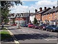
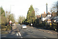
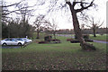
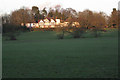
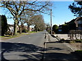
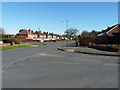
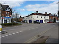
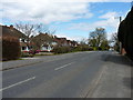
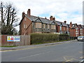
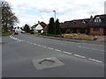
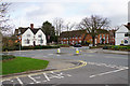

34 photos from this area
Area Information
Key information about the B93 9JT including its size, population, and administrative classification.
- Area Type
- Postcode
- Area Size
- 1.0 hectares
- Population
- 1784
- Population Density
- 763 people/km²
House Prices in B93 9JT
18
Properties
£361,361
Average Sold Price
£110,000
Lowest Price
£622,500
Highest Price
Showing 18 properties
| Address | Type | Beds | Baths | Last Sale Price | Last Sale Date | |
|---|---|---|---|---|---|---|
| 50 Barcheston Road, Knowle, Solihull, B93 9JT | house | 4 | 1 | £600,000 | Dec 2024 | |
| 58 Barcheston Road, Knowle, Solihull, B93 9JT | Detached | - | - | £622,500 | Feb 2021 | |
| 70 Barcheston Road, Knowle, Solihull, B93 9JT | house | - | - | £523,000 | May 2018 | |
| 60 Barcheston Road, Knowle, Solihull, B93 9JT | Detached | 4 | - | £460,010 | Feb 2015 | |
| 56 Barcheston Road, Knowle, Solihull, B93 9JT | Detached | 4 | 2 | £445,650 | Jun 2014 | |
| 76 Barcheston Road, Knowle, Solihull, B93 9JT | Detached | 2 | 1 | £295,000 | Mar 2011 | |
| 54 Barcheston Road, Knowle, Solihull, B93 9JT | Detached | - | - | £247,997 | Aug 2002 | |
| 48 Barcheston Road, Knowle, Solihull, B93 9JT | Detached | - | - | £189,950 | Jul 2000 | |
| 72 Barcheston Road, Knowle, Solihull, B93 9JT | Detached | - | - | £119,500 | Nov 1999 | |
| 78 Barcheston Road, Knowle, Solihull, B93 9JT | Detached | - | - | £110,000 | Nov 1997 |
Page 1 of 2
Energy Efficiency in B93 9JT
Amenities
Schools
| Rank | School | Type | Entry gender | Ages |
|---|
Explore more schools in this area
Go to Schools tabDemographics
Household Size
Two person
most common
Accommodation Type
Houses
most common
Tenure
88
majority
Ethnic Group
White
most common
Religion
N/A
most common
Household Composition
N/A
most common
Age
47
median
Adults (30-64 years)
most common
Household Deprivation
N/A
with no deprivation
NS-SEC
54
in Lower managerial occupations
Explore more demographic insights in this area
Go to Demographics tabPlanning
Planning Constraints
- Flood RiskPremium
- Ramsar Wetland SitesPremium
- Area of Outstanding Natural BeautyPremium
- Protected Nature ReservePremium
- Protected WoodlandPremium