Area Overview for B93 9DF
Photos of B93 9DF

Area Information
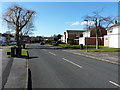
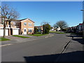
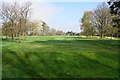
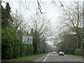
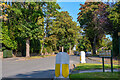
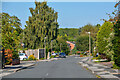
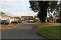
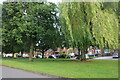
B93 9DF is a specific postcode covering a small residential cluster in Knowle, West Midlands. This area sits within the large village of Knowle, part of the Metropolitan Borough of Solihull. The settlement is located approximately 5 km east-southeast of Solihull town centre. You are living in a historic part of Warwickshire that sits mid-way between Birmingham and Warwick. The A4141 runs through the region, connecting these two major cities. This specific postcode covers an area of 6708 square metres. The location is defined by its retention of historic character alongside modern residential development. The High Street and the 15th-century church form the core of the local conservation area. You are positioned on a route that was once a key stage-coach stop on the journey from Birmingham to London. The Grand Union Canal, opened in 1799, runs nearby with its flight of five locks. Daily life here blends agricultural heritage with suburban convenience. You benefit from proximity to a 15th-century landmark and a designated conservation area first established in March 1968. The community retains the charm of a village atmosphere despite significant post-war expansion.
- Area Type
- Postcode
- Area Size
- 6708 m²
- Population
- 1825
- Population Density
- 3106 people/km²
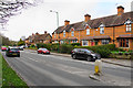
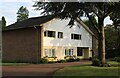
The housing market in B93 9DF is dominated by owner-occupiers rather than private landlords. Eighty-five per cent of homes in this postcode are owned by their residents. The primary accommodation type consists of houses, fitting the village character of Knowle. You are looking at an area where property values may be stable due to the high level of home retention. The specific postcode covers a small cluster of land measuring 6708 square metres. This scarcity of space often supports resilient property prices as supply is naturally limited. Buying here means joining a community where residents are likely to stay for the long term. The surrounding wider area of Knowle has seen rapid suburban expansion between the wars and after 1959. Many properties date from these periods, offering a mix of historic and mid-century homes. The conservation area status focuses on the High Street and extends into Warwick Road. This restriction protects the architectural style of the properties that define the streetscape. If you buy here, you are investing in a location with strong historical significance and defined planning constraints.
House Prices in B93 9DF
Showing 9 properties
| Address | Type | Beds | Baths | Last Sale Price | Last Sale Date | |
|---|---|---|---|---|---|---|
| 17 Wychwood Avenue, Knowle, Solihull, B93 9DF | house | - | - | £300,000 | Sep 2019 | |
| 31 Wychwood Avenue, Knowle, Solihull, B93 9DF | Detached | 3 | 2 | £580,000 | Dec 2018 | |
| 29 Wychwood Avenue, Knowle, Solihull, B93 9DF | house | - | - | £940,000 | May 2018 | |
| 23 Wychwood Avenue, Knowle, Solihull, B93 9DF | house | 4 | - | £900,000 | Sep 2017 | |
| 21 Wychwood Avenue, Knowle, Solihull, B93 9DF | house | - | - | £547,000 | Feb 2010 | |
| 25 Wychwood Avenue, Knowle, Solihull, B93 9DF | Detached | - | - | £515,000 | May 2007 | |
| 27 Wychwood Avenue, Knowle, Solihull, B93 9DF | Detached | - | - | £490,000 | May 2004 | |
| 15 Wychwood Avenue, Knowle, Solihull, B93 9DF | Detached | 4 | 1 | - | - | |
| 19 Wychwood Avenue, Knowle, Solihull, B93 9DF | Detached | - | - | - | - |
Energy Efficiency in B93 9DF
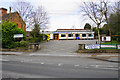
Living in B93 9DF offers convenient access to essential retail and leisure facilities. Tesco Knowle, Co-op Bentley, and Asda Widney serve the local shopping needs. These five major retailers are listed among the nearest amenities retailers. You do not need to travel far for groceries or household essentials. The area has a rich history dating back to 1200 when William de Arden conveyed the town to his wife. Eighty-one young men from Knowle died during the First World War, and the Soldiers' Chapel opened in 1921 as a memorial. The Grand Union Canal features a thriving boatyard, moorings, and two pubs within walking distance. The Knowle Conservation Area protects historic timber-framed buildings dating from the 16th and 17th centuries. You can enjoy the charm of the High Street while accessing modern conveniences. The village transformed from an agricultural settlement into a residential community over the 20th century. This transition preserves the original layout while adding new homes and services.
Amenities
Schools
Families living in B93 9DF have access to several Church of England schools nearby. Knowle CofE Junior School is a primary institution serving local children. Knowle CofE Infant School caters to younger pupils in the primary phase. Knowle Church of England Primary School is also available for primary education. Knowle Church of England Primary Academy holds a good Ofsted rating, offering a positive educational environment. These schools are clustered together, reflecting the village church community spirit. You will find no secondary schools listed in the immediate data for this specific postcode. The presence of multiple primary options suggests a catchment area that supports growing families. The variety of church-affiliated institutions indicates a strong local commitment to religious education. Parents may note the good rating from Ofsted as a key positive for Knowle Church of England Primary Academy. The proximity of these schools aligns with the residential nature of the area. Families benefit from knowing that education facilities are within practical reach of their homes.
| Rank | School | Type | Entry gender | Ages |
|---|
Explore more schools in this area
Go to Schools tabDemographics
The people living in B93 9DF form a mature community centred on adults aged between 30 and 64 years. The median age for residents is 47 years old. This age profile suggests a neighbourhood dominated by established families and owners rather than young tenants. Eighty-five per cent of households own their homes, indicating a deeply settled population with long-term roots in Knowle. The accommodation type is primarily houses, consistent with the area's historic village layout and post-war expansion. The predominant ethnic group is White, reflecting the traditional demographic makeup of this part of Solihull. You are surrounded by neighbours who have likely lived in their properties for decades. The population density is 272,065 people per square kilometre, a figure derived from the small size of this specific postcode cluster. This high density indicates a concentrated community feel within the wider Knowle ward. Most residents are of middle-to-upper-middle income status given the high homeownership rate. The area attracts those seeking stability and a connection to local history.
Household Size
Accommodation Type
Tenure
Ethnic Group
Religion
Household Composition
Age
Household Deprivation
NS-SEC
Explore more demographic insights in this area
Go to Demographics tabPlanning
Planning Constraints
- Flood RiskPremium
- Ramsar Wetland SitesPremium
- Area of Outstanding Natural BeautyPremium
- Protected Nature ReservePremium
- Protected WoodlandPremium