Area Overview for B93 8RS
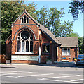
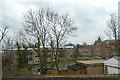
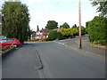
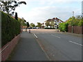
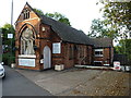
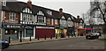
Photos of B93 8RS


Area Information
Living in B93 8RS means being part of a small, tightly knit residential cluster within the Metropolitan Borough of Solihull. With a population of 1,424, the area retains the character of a suburban village despite its proximity to Solihull. Historically rooted in the Parish of Solihull, Olton was once an independent settlement, its name deriving from the Saxon "old town." Today, it balances rural tranquillity with modern convenience. The area’s median age of 47 suggests a community of established residents, many of whom are homeowners—93% of households own their homes. This high ownership rate, combined with a predominance of houses, reflects a stable, family-oriented environment. The low crime risk score of 91/100 and absence of environmental constraints like AONB or protected woodlands make it appealing for those seeking safety and practicality. Residents benefit from proximity to retail, rail, and metro links, while nearby features like Olton Mere add a touch of natural beauty. For buyers, B93 8RS offers a blend of heritage, security, and accessibility.
- Area Type
- Postcode
- Area Size
- Not available
- Population
- 1424
- Population Density
- 3233 people/km²
The property market in B93 8RS is defined by high home ownership—93% of residents own their homes—suggesting a strong demand for owner-occupied housing. The area’s accommodation type is predominantly houses, which are typically larger and suited to families or individuals seeking space. Given the small size of the postcode area, the housing stock is likely limited, with properties concentrated in a compact cluster. This could mean a competitive market for buyers, though the high ownership rate indicates a stable, long-term resident base. The absence of rental data means it is unclear whether the area also attracts tenants, but the focus on owner-occupation suggests limited availability of rental properties. For buyers, the mix of houses and the area’s safety profile make it an attractive option for those prioritising security and permanence.
House Prices in B93 8RS
No properties found in this postcode.
Energy Efficiency in B93 8RS
Residents of B93 8RS have access to a range of amenities within practical reach. Retail options include five local shops, such as Spar, Cook Solihull, and Co-op Northfield, offering everyday essentials. The area’s rail network, with stations like Olton and Solihull, connects to broader transport systems, while metro links to Birmingham International Airport and Corporation Street cater to both business and leisure travel. Though the data does not mention parks or leisure facilities, the historical presence of Olton Mere—a significant body of water—suggests nearby natural spaces for recreation. The suburban character of the area, combined with its proximity to retail and transport hubs, supports a lifestyle that balances convenience with a sense of community.
Amenities
Schools
The nearest school to B93 8RS is Oak Cottage Primary School, which holds an outstanding Ofsted rating. This primary school is a key asset for families with young children, offering high-quality early education. The absence of secondary schools in the immediate area means students may need to travel to nearby towns for secondary education, though the data does not specify distances or options. The presence of a top-rated primary school enhances the area’s appeal for families, ensuring children receive a strong educational foundation. With no other schools listed, the educational landscape is focused on primary provision, which may influence decisions about long-term residency for households with older children.
| Rank | School | Type | Entry gender | Ages |
|---|
Explore more schools in this area
Go to Schools tabDemographics
The community in B93 8RS is predominantly composed of adults aged 30–64, with a median age of 47. This suggests a mature, settled population, likely with long-term ties to the area. Home ownership is exceptionally high at 93%, indicating a strong preference for property as a long-term investment. The accommodation type is largely houses, reflecting a residential character that contrasts with more densely populated zones. The predominant ethnic group is White, though no specific data on diversity or deprivation levels is provided. The age profile implies a community focused on stability, with fewer young families or retirees compared to areas with broader age ranges. This demographic structure may influence local services and amenities, which are tailored to the needs of middle-aged residents. The absence of detailed diversity statistics means the area’s social composition remains largely unexplored in the data.
Household Size
Accommodation Type
Tenure
Ethnic Group
Religion
Household Composition
Age
Household Deprivation
NS-SEC
Explore more demographic insights in this area
Go to Demographics tabPlanning
Planning Constraints
- Flood RiskPremium
- Ramsar Wetland SitesPremium
- Area of Outstanding Natural BeautyPremium
- Protected Nature ReservePremium
- Protected WoodlandPremium