Area Overview for B93 8HW
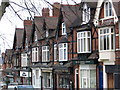
Photos of B93 8HW
Area Information
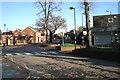
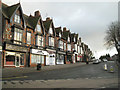
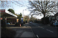
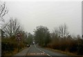
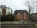
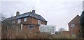
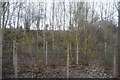
B93 8HW sits in the heart of Dorridge and Hockley Heath, a small residential cluster in Solihull, West Midlands. With a population of 1,553, it blends suburban comfort with rural charm, shaped by 19th-century railway development and ancient woodland. The area’s character is defined by substantial family homes, converted mansions, and village-centric roads like Stratford Road. Dorridge, a few miles north-east of Hockley Heath, is a hub of quiet affluence, with pockets of farmland-turned-estates. The ward’s history stretches back to the 1400s, marked by landmarks like Dorridge Park (donated in 1965) and the Four Ashes trees, which still stand as boundary markers from 1662. Residents benefit from proximity to motorways (M42/M40) and rail links, with Dorridge Station offering swift connections to Birmingham and beyond. Daily life here is punctuated by local resistance to developers, preserving the area’s traditional feel. The median age of 47 suggests a stable, mature community, with many residents rooted in the area for generations.
- Area Type
- Postcode
- Area Size
- Not available
- Population
- 1553
- Population Density
- 1759 people/km²
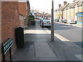
B93 8HW is predominantly an owner-occupied area, with 91% of homes owned by residents rather than rented. The accommodation type is primarily houses, which are more common than flats in this small cluster. This suggests a housing stock tailored to families and individuals seeking larger, more permanent residences. The limited size of the area means the property market is constrained, with few new developments. Buyers should expect competition for the existing homes, which range from traditional family houses to converted mansions. The high home ownership rate indicates a stable market with little turnover, making it a low-risk area for long-term investment. However, the scarcity of available properties may limit options for buyers, particularly those seeking specific features. The presence of historic estates and village-style homes adds to the area’s distinctiveness, though buyers should consider the limited scope for expansion in this tightly defined postcode.
House Prices in B93 8HW
No properties found in this postcode.
Energy Efficiency in B93 8HW
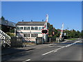
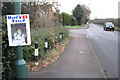
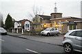
Living in B93 8HW offers a mix of convenience and charm, with nearby amenities within practical reach. Retail options include Tesco Dorridge, Sainsburys Dorridge, and Asda Widney, providing everyday shopping needs. The area’s rail network is well-served by Dorridge, Widney Manor, and Lapworth stations, while Birmingham International Airport is accessible via metro services. Parks and green spaces like Dorridge Park offer recreational opportunities, and historical landmarks such as the Four Ashes trees and the Drum and Monkey pub add character. Education is covered by Hockley Heath Primary Academy, established in 1913. The village atmosphere, centred on roads like Stratford Road, fosters a sense of community. Residents can enjoy a blend of suburban comfort and rural elements, with local amenities supporting both daily needs and leisure. The area’s mix of shops, transport, and green spaces makes it appealing for families and professionals seeking balance.
Amenities
Schools
| Rank | School | Type | Entry gender | Ages |
|---|
Explore more schools in this area
Go to Schools tabDemographics
The population of B93 8HW is predominantly adults aged 30–64, with a median age of 47. Over 91% of homes are owner-occupied, reflecting a community of long-term residents rather than renters. The area is largely composed of houses, not flats, which aligns with its suburban character. The predominant ethnic group is White, though specific diversity statistics are not detailed. The high home ownership rate and age profile suggest a family-oriented, low-turnover environment. With 91% of residents owning their homes, the area lacks the transient nature of rental markets, fostering a sense of stability. The absence of detailed data on deprivation or income levels means the quality of life is inferred from the area’s safety, amenities, and transport links. The demographic profile indicates a mature, established community with limited generational turnover, which may appeal to buyers seeking consistency and low crime rates.
Household Size
Accommodation Type
Tenure
Ethnic Group
Religion
Household Composition
Age
Household Deprivation
NS-SEC
Explore more demographic insights in this area
Go to Demographics tabPlanning
Planning Constraints
- Flood RiskPremium
- Ramsar Wetland SitesPremium
- Area of Outstanding Natural BeautyPremium
- Protected Nature ReservePremium
- Protected WoodlandPremium