Area Overview for B93 8HU
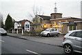
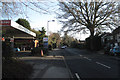
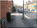
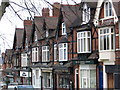
Photos of B93 8HU


Area Information
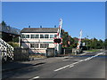
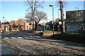
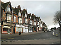
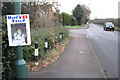
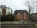
Living in B93 8HU means inhabiting a small, tightly knit residential cluster within the Dorridge and Hockley Heath Ward of Solihull. With a population of 1,714 and a density of 637 people per square kilometre, this area blends suburban comfort with rural charm. Historically shaped by 19th-century railway development and ancient woodland, it retains a village atmosphere centred on roads like Stratford Road. The area’s affluent character is evident in its substantial family homes, converted mansions, and farmland-turned-estates. Residents benefit from proximity to both urban and natural environments, with easy access to Birmingham’s motorways and nearby green spaces like Dorridge Park. The ward’s history, from medieval woodland grants to 1930s housing developments, underpins a community that values stability and local heritage. Daily life here is defined by quiet streets, a strong sense of place, and a mix of historical landmarks and modern amenities. For those seeking a balance between suburban living and rural tranquillity, B93 8HU offers a distinctive blend of both.
- Area Type
- Postcode
- Area Size
- Not available
- Population
- 1714
- Population Density
- 637 people/km²
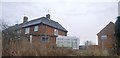
The property market in B93 8HU is dominated by owner-occupied homes, with 92% of properties in private hands. This high ownership rate indicates a stable, long-term resident base rather than a rental-heavy market. The accommodation type is predominantly houses, suggesting a focus on family homes and larger properties. This contrasts with areas where flats or apartments dominate, and it may appeal to buyers seeking spacious, traditional housing. Given the small size of the postcode area, the housing stock is likely limited to a cluster of residential properties, possibly including converted mansions and newer developments. For buyers, this means a market prioritising quality over quantity, with properties likely to be in good condition and well-maintained. The emphasis on houses also implies that the area may not be ideal for those seeking smaller or more modern living spaces.
House Prices in B93 8HU
No properties found in this postcode.
Energy Efficiency in B93 8HU
Residents of B93 8HU have access to a range of nearby amenities, including five retail outlets such as Sainsburys Dorridge, Tesco Dorridge, and Asda Widney. These shops provide convenience for everyday needs, from groceries to household supplies. The area’s transport links also grant access to leisure and travel opportunities, with Birmingham International Airport and railway stations offering easy access to regional and national destinations. Parks and green spaces, such as Dorridge Park, contribute to a balanced lifestyle, offering recreational opportunities. The village atmosphere, with its historic roads and landmarks like the Church of St Thomas, adds to the area’s character. The mix of retail, transport, and green spaces ensures a convenient and varied daily life, blending practicality with a sense of community.
Amenities
Schools
The nearest school to B93 8HU is St George and St Teresa Catholic Primary School, which serves the local community with primary education. This school holds a good Ofsted rating, indicating a reliable standard of teaching and facilities. The presence of a primary school suggests that the area is well-suited for families with young children, though no secondary schools are listed in the data. The single school option may require families to consider commuting for secondary education, but the good rating at the primary level offers reassurance about early years’ learning. The absence of other schools in the immediate vicinity means that prospective buyers should factor in transport options for older children.
| Rank | School | Type | Entry gender | Ages |
|---|---|---|---|---|
| 1 | St George and St Teresa Catholic Primary School | primary | N/A | N/A |
| 2 | St George and St Teresa Catholic Primary School | primary | N/A | N/A |
Explore more schools in this area
Go to Schools tabDemographics
The population of B93 8HU is predominantly composed of adults aged 30–64, with a median age of 47. This suggests a community of established professionals and families, many of whom own their homes—92% of properties are owner-occupied. The area is characterised by houses rather than flats, reflecting a focus on traditional family housing. The predominant ethnic group is White, though specific diversity metrics are not provided. The age profile indicates a mature demographic, which may influence local services and amenities. With a low proportion of younger residents, the area may cater more to long-term residents than to transient populations. The high home ownership rate and stable age distribution suggest a community with strong ties to the area, likely prioritising security and long-term investment over rental flexibility.
Household Size
Accommodation Type
Tenure
Ethnic Group
Religion
Household Composition
Age
Household Deprivation
NS-SEC
Explore more demographic insights in this area
Go to Demographics tabPlanning
Planning Constraints
- Flood RiskPremium
- Ramsar Wetland SitesPremium
- Area of Outstanding Natural BeautyPremium
- Protected Nature ReservePremium
- Protected WoodlandPremium
- Crime RiskPremium