Area Overview for B93 8EZ
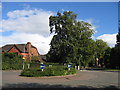
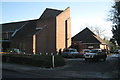
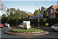
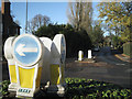
Photos of B93 8EZ
Area Information
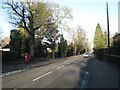
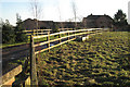
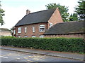
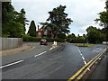
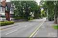
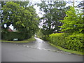
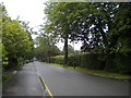
Living in B93 8EZ means inhabiting a small, tightly knit residential cluster in the heart of Dorridge and Hockley Heath, part of Solihull’s suburban-rural landscape. The area spans 3,310 square metres, housing 1,714 residents in a mix of substantial family homes and historic properties. Its character stems from 19th-century railway development in Dorridge and ancient woodland roots in Hockley Heath, creating a blend of affluence and village charm. Roads like Stratford Road connect to broader networks, while nearby landmarks such as Dorridge Park and the Four Ashes trees offer green spaces. The community thrives on local amenities, from schools to rail links, and its proximity to motorways like the M42 ensures easy access to Birmingham and beyond. With a population density of 637 people per square kilometre, B93 8EZ balances suburban comfort with a sense of seclusion, appealing to families and professionals seeking stability in a historically rich setting.
- Area Type
- Postcode
- Area Size
- 3310 m²
- Population
- 1714
- Population Density
- 637 people/km²
B93 8EZ is a largely owner-occupied area, with 92% of homes owned by residents rather than rented. The accommodation type is predominantly houses, suggesting a market skewed towards family homes and larger properties. This contrasts with areas where flats or apartments dominate, and it indicates a focus on long-term investment rather than short-term rental opportunities. The small size of the postcode area means the housing stock is limited, but the prevalence of houses suggests a mix of traditional and newer builds. For buyers, this implies a market where properties are likely to hold value, though competition may be fierce due to the area’s appeal. Proximity to amenities like schools and transport links further enhances its desirability for those prioritising convenience and stability.
House Prices in B93 8EZ
Showing 2 properties
| Address | Type | Beds | Baths | Last Sale Price | Last Sale Date | |
|---|---|---|---|---|---|---|
| St George And St Theresa Parish Hall, Station Road, Dorridge, Solihull, B93 8EZ | commercial | - | - | - | - | |
| 337 Station Road, Dorridge, Solihull, B93 8EZ | Detached | - | - | - | - |
Energy Efficiency in B93 8EZ
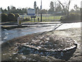
Daily life in B93 8EZ is shaped by its proximity to a range of amenities. Retail options include Sainsburys Dorridge, Tesco Dorridge, and Asda Widney, providing convenience for shopping. The area’s rail network, with stations like Dorridge and Widney Manor, connects residents to broader transport routes, while Birmingham International Airport offers easy travel. Parks such as Dorridge Park and historical sites like the Four Ashes trees provide recreational spaces. The village atmosphere, centred on roads like Stratford Road, fosters a sense of community. With a mix of retail, transport, and green spaces, B93 8EZ offers a lifestyle that balances practicality with charm.
Amenities
Schools
The primary school nearest to B93 8EZ is St George and St Teresa Catholic Primary School, which serves the area with a good Ofsted rating. This school is the only one listed in the data, indicating a focus on primary education for local families. The absence of secondary schools or additional educational institutions means parents may need to look beyond the immediate vicinity for secondary education. However, the good Ofsted rating suggests a reliable standard of teaching and facilities, which is crucial for families prioritising quality education. The presence of a single primary school also implies a close-knit community where children are likely to be known by teachers and staff, fostering a sense of security and familiarity.
| Rank | School | Type | Entry gender | Ages |
|---|
Explore more schools in this area
Go to Schools tabDemographics
The population of B93 8EZ is 1,714, with a median age of 47 and the majority aged between 30 and 64. This suggests a community of established residents, many of whom are likely middle-aged professionals or families. Home ownership is exceptionally high at 92%, indicating a stable, long-term demographic. The area is predominantly composed of houses, reflecting a preference for single-family dwellings over flats or apartments. The predominant ethnic group is White, though specific data on diversity is not provided. The low population density of 637 people per square kilometre implies a more spread-out, less congested living environment. This profile aligns with the area’s affluent suburban character, where long-term residency and family-oriented living are the norm.
Household Size
Accommodation Type
Tenure
Ethnic Group
Religion
Household Composition
Age
Household Deprivation
NS-SEC
Explore more demographic insights in this area
Go to Demographics tabPlanning
Planning Constraints
- Flood RiskPremium
- Ramsar Wetland SitesPremium
- Area of Outstanding Natural BeautyPremium
- Protected Nature ReservePremium
- Protected WoodlandPremium