Area Overview for B93 0LP
Photos of B93 0LP

Area Information
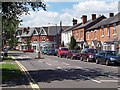
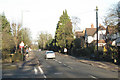
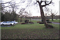
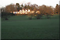
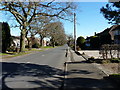
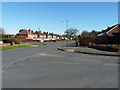
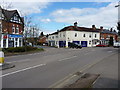
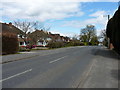
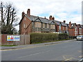
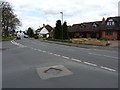
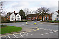
Living in B93 0LP means inhabiting a small, tightly knit residential cluster in the heart of Knowle, a village with a rich historical legacy and a modern, family-oriented character. The area’s population of 1,635 residents, spread across 865 people per square kilometre, reflects a compact community where historic charm meets practical living. Knowle’s transformation from an agricultural settlement to a residential hub is evident in its Conservation Area, centred on the High Street and the 15th-century church. This area retains its village atmosphere despite post-war development, with timber-framed buildings and the Grand Union Canal’s flight of five locks adding to its appeal. Proximity to Birmingham and Warwick via the A4141 road ensures easy access to urban amenities, while the village’s focus on retail and housing creates a self-contained environment. Daily life here balances the quietude of a historic settlement with the convenience of nearby rail links and modern infrastructure, making it ideal for those seeking a blend of heritage and accessibility.
- Area Type
- Postcode
- Area Size
- Not available
- Population
- 1635
- Population Density
- 865 people/km²
The property market in B93 0LP is defined by its 61% home ownership rate and a predominance of houses over flats, reflecting a suburban, family-oriented character. This suggests a market where owner-occupation is common, though rental properties also exist, particularly for those seeking long-term stability. The focus on houses rather than apartments indicates a demand for larger living spaces, likely catering to families or individuals prioritising space and privacy. Given the area’s small size and high population density, the housing stock is limited, meaning buyers may need to consider nearby zones for more options. The balance between owner-occupied and rental properties hints at a community where property values are stable but not speculative, offering a pragmatic approach to housing that aligns with the area’s historical and practical appeal.
House Prices in B93 0LP
No properties found in this postcode.
Energy Efficiency in B93 0LP
Residents of B93 0LP have access to a range of amenities that blend practicality with charm. The High Street offers a village atmosphere, with shops like Tesco Knowle, Asda Widney, and Co-op Bentley providing daily essentials. The Grand Union Canal, with its iconic flight of five locks, offers leisure opportunities, alongside nearby pubs and a thriving boatyard. Rail stations such as Dorridge and Solihull provide easy access to Birmingham’s cultural and commercial hubs, while Birmingham International Airport is within reach for travel. The area’s historic buildings and Conservation Area contribute to a sense of continuity, ensuring daily life here feels rooted in tradition yet connected to modern convenience.
Amenities
Schools
| Rank | School | Type | Entry gender | Ages |
|---|
Explore more schools in this area
Go to Schools tabDemographics
The community in B93 0LP is predominantly composed of adults aged 30–64, with a median age of 47, reflecting a mature, stable population. Home ownership stands at 61%, indicating a mix of long-term residents and owner-occupied properties, though rental options are also present. The area is characterised by houses rather than flats, aligning with its suburban, family-friendly profile. The predominant ethnic group is White, which shapes the cultural and social dynamics of the neighbourhood. With a population density of 865 people per square kilometre, the area feels lived-in but not overcrowded. This demographic profile suggests a community focused on established living, with limited presence of younger families or transient populations. The age range and ownership rates imply a balance between generational stability and the potential for intergenerational living arrangements.
Household Size
Accommodation Type
Tenure
Ethnic Group
Religion
Household Composition
Age
Household Deprivation
NS-SEC
Explore more demographic insights in this area
Go to Demographics tabPlanning
Planning Constraints
- Flood RiskPremium
- Ramsar Wetland SitesPremium
- Area of Outstanding Natural BeautyPremium
- Protected Nature ReservePremium
- Protected WoodlandPremium