Area Overview for B93 0DX
Photos of B93 0DX
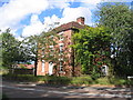

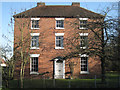
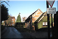
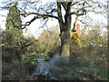
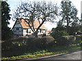


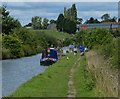
32 photos from this area
Area Information
Key information about the B93 0DX including its size, population, and administrative classification.
- Area Type
- Postcode
- Area Size
- 40.8 hectares
- Population
- 1784
- Population Density
- 763 people/km²
House Prices in B93 0DX
10
Properties
£1,285,000
Average Sold Price
£295,000
Lowest Price
£2,275,000
Highest Price
Showing 10 properties
| Address | Type | Beds | Baths | Last Sale Price | Last Sale Date | |
|---|---|---|---|---|---|---|
| 1820 Warwick Road, Knowle, Solihull, B93 0DX | house | - | - | £2,275,000 | Oct 2025 | |
| 1927 Warwick Road, Knowle, Solihull, B93 0DX | Semi-detached | 4 | 2 | £295,000 | Sep 2022 | |
| Money Doctor Financial Planning Ltd, Unit 2 Suite 2, Rotton Row Farm, 1959 Warwick Road, Knowle, Solihull, B93 0DX | Office | - | - | - | - | |
| Mccoy Contractors Ltd, Unit 1 Suite 2, Rotton Row Farm, 1959 Warwick Road, Knowle, Solihull, B93 0DX | Office | - | - | - | - | |
| 1959 Warwick Road, Knowle, Solihull, B93 0DX | Detached | - | - | - | - | |
| Money Doctor Financial Planning Ltd, Unit 2C, Rotton Row Farm, 1959 Warwick Road, Knowle, Solihull, B93 0DX | Office | - | - | - | - | |
| 1929 Warwick Road, Knowle, Solihull, B93 0DX | Detached | - | - | - | - | |
| 1939 Warwick Road, Knowle, Solihull, B93 0DX | Detached | - | - | - | - | |
| 1925 Warwick Road, Knowle, Solihull, B93 0DX | Semi-detached | - | - | - | - | |
| Money Doctor Financial Planning Ltd, Unit 2 Suite 1, Rotton Row Farm, 1959 Warwick Road, Knowle, Solihull, B93 0DX | Office | - | - | - | - |
Energy Efficiency in B93 0DX
Amenities
Schools
| Rank | School | Type | Entry gender | Ages |
|---|
Explore more schools in this area
Go to Schools tabDemographics
Household Size
Two person
most common
Accommodation Type
Houses
most common
Tenure
88
majority
Ethnic Group
White
most common
Religion
N/A
most common
Household Composition
N/A
most common
Age
47
median
Adults (30-64 years)
most common
Household Deprivation
N/A
with no deprivation
NS-SEC
54
in Lower managerial occupations
Explore more demographic insights in this area
Go to Demographics tabPlanning
Planning Constraints
- Flood RiskPremium
- Ramsar Wetland SitesPremium
- Area of Outstanding Natural BeautyPremium
- Protected Nature ReservePremium
- Protected WoodlandPremium