Area Overview for B92 9PS
Photos of B92 9PS

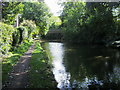
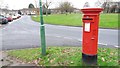
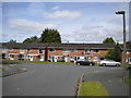
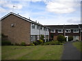
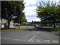
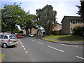
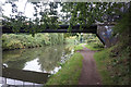
48 photos from this area
Area Information
Key information about the B92 9PS including its size, population, and administrative classification.
- Area Type
- Postcode
- Area Size
- 5443 m²
- Population
- 2199
- Population Density
- 6454 people/km²
House Prices in B92 9PS
16
Properties
£133,958
Average Sold Price
£57,000
Lowest Price
£248,000
Highest Price
Showing 16 properties
| Address | Type | Beds | Baths | Last Sale Price | Last Sale Date | |
|---|---|---|---|---|---|---|
| 63 Draycote Close, Solihull, B92 9PS | Maisonette | 2 | 1 | £165,000 | Sep 2023 | |
| 59 Draycote Close, Solihull, B92 9PS | Maisonette | 2 | 1 | £165,000 | Jul 2023 | |
| 57 Draycote Close, Solihull, B92 9PS | Maisonette | 2 | 1 | £170,000 | Jul 2023 | |
| 77 Draycote Close, Solihull, B92 9PS | Semi-detached | 3 | 2 | £248,000 | Apr 2023 | |
| 75 Draycote Close, Solihull, B92 9PS | Maisonette | 2 | - | £160,000 | Mar 2022 | |
| 69 Draycote Close, Solihull, B92 9PS | Flat | - | - | £145,000 | Dec 2021 | |
| 61 Draycote Close, Solihull, B92 9PS | Maisonette | 2 | 1 | £132,000 | Oct 2018 | |
| 65 Draycote Close, Solihull, B92 9PS | Maisonette | 2 | - | £106,000 | Nov 2015 | |
| 73 Draycote Close, Solihull, B92 9PS | Maisonette | - | - | £102,000 | Sep 2004 | |
| 71 Draycote Close, Solihull, B92 9PS | Terraced | - | - | £111,500 | Sep 2003 |
Page 1 of 2
Energy Efficiency in B92 9PS
Amenities
Schools
| Rank | School | Type | Entry gender | Ages |
|---|
Explore more schools in this area
Go to Schools tabDemographics
Household Size
One person
most common
Accommodation Type
Houses
most common
Tenure
53
majority
Ethnic Group
White
most common
Religion
N/A
most common
Household Composition
N/A
most common
Age
47
median
Adults (30-64 years)
most common
Household Deprivation
N/A
with no deprivation
NS-SEC
33
in Lower managerial occupations
Explore more demographic insights in this area
Go to Demographics tabPlanning
Planning Constraints
- Flood RiskPremium
- Ramsar Wetland SitesPremium
- Area of Outstanding Natural BeautyPremium
- Protected Nature ReservePremium
- Protected WoodlandPremium