Area Overview for B92 9NZ
Photos of B92 9NZ
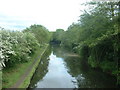
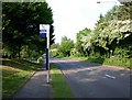
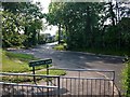
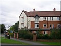
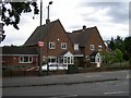
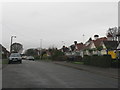


53 photos from this area
Area Information
Key information about the B92 9NZ including its size, population, and administrative classification.
- Area Type
- Postcode
- Area Size
- 1.6 hectares
- Population
- 2199
- Population Density
- 6454 people/km²
House Prices in B92 9NZ
53
Properties
£148,624
Average Sold Price
£28,950
Lowest Price
£235,000
Highest Price
Showing 53 properties
| Address | Type | Beds | Baths | Last Sale Price | Last Sale Date | |
|---|---|---|---|---|---|---|
| 5 Foredrove Lane, Solihull, B92 9NZ | Terraced | 3 | 1 | £220,000 | Sep 2025 | |
| 49 Foredrove Lane, Solihull, B92 9NZ | Terraced | 3 | 1 | £185,000 | Jul 2024 | |
| 43 Foredrove Lane, Solihull, B92 9NZ | Terraced | 3 | 1 | £154,000 | Aug 2023 | |
| 45 Foredrove Lane, Solihull, B92 9NZ | Terraced | 3 | 1 | £225,000 | Mar 2022 | |
| 42 Foredrove Lane, Solihull, B92 9NZ | Terraced | - | - | £235,000 | Sep 2021 | |
| 14 Foredrove Lane, Solihull, B92 9NZ | Flat | - | - | £111,000 | Aug 2021 | |
| 52 Foredrove Lane, Solihull, B92 9NZ | Flat | - | - | £105,000 | Apr 2021 | |
| 3 Foredrove Lane, Solihull, B92 9NZ | Terraced | 3 | - | £195,000 | Feb 2021 | |
| 30 Foredrove Lane, Solihull, B92 9NZ | house | - | - | £220,000 | Oct 2018 | |
| 33 Foredrove Lane, Solihull, B92 9NZ | Terraced | 3 | 1 | £185,000 | Mar 2018 |
Page 1 of 6
Energy Efficiency in B92 9NZ
Amenities
Schools
| Rank | School | Type | Entry gender | Ages |
|---|
Explore more schools in this area
Go to Schools tabDemographics
Household Size
One person
most common
Accommodation Type
Houses
most common
Tenure
53
majority
Ethnic Group
White
most common
Religion
N/A
most common
Household Composition
N/A
most common
Age
47
median
Adults (30-64 years)
most common
Household Deprivation
N/A
with no deprivation
NS-SEC
33
in Lower managerial occupations
Explore more demographic insights in this area
Go to Demographics tabPlanning
Planning Constraints
- Flood RiskPremium
- Ramsar Wetland SitesPremium
- Area of Outstanding Natural BeautyPremium
- Protected Nature ReservePremium
- Protected WoodlandPremium