Area Overview for B92 9LL
Photos of B92 9LL

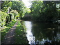
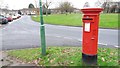
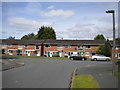
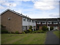
48 photos from this area
Area Information
Key information about the B92 9LL including its size, population, and administrative classification.
- Area Type
- Postcode
- Area Size
- 1.6 hectares
- Population
- 2199
- Population Density
- 6454 people/km²
House Prices in B92 9LL
30
Properties
£122,385
Average Sold Price
£54,000
Lowest Price
£170,000
Highest Price
Showing 30 properties
| Address | Type | Beds | Baths | Last Sale Price | Last Sale Date | |
|---|---|---|---|---|---|---|
| 163 Rowood Drive, Solihull, B92 9LL | Flat | 2 | 1 | £153,000 | Apr 2023 | |
| 169 Rowood Drive, Solihull, B92 9LL | Maisonette | - | - | £165,000 | Sep 2021 | |
| 336 Rowood Drive, Solihull, B92 9LL | Maisonette | 2 | 1 | £165,750 | Mar 2020 | |
| 362 Rowood Drive, Solihull, B92 9LL | Maisonette | 2 | 1 | £145,000 | Jan 2020 | |
| 338 Rowood Drive, Solihull, B92 9LL | Maisonette | 2 | 1 | £122,000 | Jan 2020 | |
| 161 Rowood Drive, Solihull, B92 9LL | Maisonette | 2 | 1 | £170,000 | Dec 2019 | |
| 348 Rowood Drive, Solihull, B92 9LL | Maisonette | 3 | 1 | £160,000 | Jul 2017 | |
| 350 Rowood Drive, Solihull, B92 9LL | Maisonette | 2 | 1 | £140,000 | Apr 2017 | |
| 360 Rowood Drive, Solihull, B92 9LL | Maisonette | 2 | - | £136,000 | Dec 2016 | |
| 354 Rowood Drive, Solihull, B92 9LL | Maisonette | 2 | 1 | £98,000 | Oct 2013 |
Page 1 of 3
Energy Efficiency in B92 9LL
Amenities
Schools
| Rank | School | Type | Entry gender | Ages |
|---|
Explore more schools in this area
Go to Schools tabDemographics
Household Size
One person
most common
Accommodation Type
Houses
most common
Tenure
53
majority
Ethnic Group
White
most common
Religion
N/A
most common
Household Composition
N/A
most common
Age
47
median
Adults (30-64 years)
most common
Household Deprivation
N/A
with no deprivation
NS-SEC
33
in Lower managerial occupations
Explore more demographic insights in this area
Go to Demographics tabPlanning
Planning Constraints
- Flood RiskPremium
- Ramsar Wetland SitesPremium
- Area of Outstanding Natural BeautyPremium
- Protected Nature ReservePremium
- Protected WoodlandPremium