Area Overview for B92 9JZ
Photos of B92 9JZ
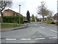
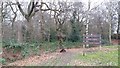
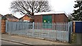
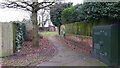
18 photos from this area
Area Information
Key information about the B92 9JZ including its size, population, and administrative classification.
- Area Type
- Postcode
- Area Size
- 9152 m²
- Population
- 1372
- Population Density
- 2957 people/km²
House Prices in B92 9JZ
20
Properties
£241,577
Average Sold Price
£60,000
Lowest Price
£400,000
Highest Price
Showing 20 properties
| Address | Type | Beds | Baths | Last Sale Price | Last Sale Date | |
|---|---|---|---|---|---|---|
| 198 Damson Lane, Solihull, B92 9JZ | Semi-detached | 3 | 1 | £400,000 | Oct 2024 | |
| 202 Damson Lane, Solihull, B92 9JZ | house | - | - | £390,000 | Mar 2021 | |
| 196 Damson Lane, Solihull, B92 9JZ | house | - | - | £325,000 | Jan 2020 | |
| 192 Damson Lane, Solihull, B92 9JZ | Semi-detached | 3 | 2 | £340,000 | Sep 2019 | |
| 188 Damson Lane, Solihull, B92 9JZ | Semi-detached | 3 | 1 | £260,000 | Nov 2017 | |
| 194 Damson Lane, Solihull, B92 9JZ | Semi-detached | 4 | 2 | £278,500 | May 2016 | |
| 216 Damson Lane, Solihull, B92 9JZ | Detached | 3 | 2 | £292,500 | Mar 2016 | |
| 208 Damson Lane, Solihull, B92 9JZ | house | - | - | £230,000 | Nov 2009 | |
| 182 Damson Lane, Solihull, B92 9JZ | Semi-detached | - | - | £185,500 | Dec 2006 | |
| 186 Damson Lane, Solihull, B92 9JZ | Semi-detached | - | - | £170,000 | Feb 2005 |
Page 1 of 2
Energy Efficiency in B92 9JZ
Amenities
Schools
| Rank | School | Type | Entry gender | Ages |
|---|
Explore more schools in this area
Go to Schools tabDemographics
Household Size
Two person
most common
Accommodation Type
Houses
most common
Tenure
94
majority
Ethnic Group
White
most common
Religion
N/A
most common
Household Composition
N/A
most common
Age
47
median
Adults (30-64 years)
most common
Household Deprivation
N/A
with no deprivation
NS-SEC
49
in Lower managerial occupations
Explore more demographic insights in this area
Go to Demographics tabPlanning
Planning Constraints
- Flood RiskPremium
- Ramsar Wetland SitesPremium
- Area of Outstanding Natural BeautyPremium
- Protected Nature ReservePremium
- Protected WoodlandPremium