Area Overview for B92 8TL
Photos of B92 8TL
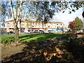
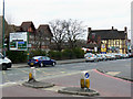
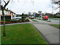
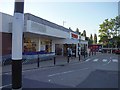
23 photos from this area
Area Information
Key information about the B92 8TL including its size, population, and administrative classification.
- Area Type
- Postcode
- Area Size
- 3.0 hectares
- Population
- 1487
- Population Density
- 4329 people/km²
House Prices in B92 8TL
71
Properties
£231,033
Average Sold Price
£15,000
Lowest Price
£495,000
Highest Price
Showing 71 properties
| Address | Type | Beds | Baths | Last Sale Price | Last Sale Date | |
|---|---|---|---|---|---|---|
| 12 Eastbury Drive, Solihull, B92 8TL | Semi-detached | 4 | 2 | £362,500 | May 2025 | |
| 30 Eastbury Drive, Solihull, B92 8TL | house | 4 | 2 | £430,000 | Mar 2025 | |
| 47 Eastbury Drive, Solihull, B92 8TL | Semi-detached | 3 | 1 | £360,000 | Dec 2024 | |
| 82 Eastbury Drive, Solihull, B92 8TL | Bungalow | - | - | £275,000 | Dec 2023 | |
| 21 Eastbury Drive, Solihull, B92 8TL | Semi-detached | 3 | 1 | £321,500 | Jun 2023 | |
| 17 Eastbury Drive, Solihull, B92 8TL | house | - | - | £384,000 | Jan 2023 | |
| 60 Eastbury Drive, Solihull, B92 8TL | Semi-detached | 3 | 2 | £325,000 | Mar 2022 | |
| 19 Eastbury Drive, Solihull, B92 8TL | Semi-detached | 4 | 1 | £323,000 | Jun 2021 | |
| 15 Eastbury Drive, Solihull, B92 8TL | Semi-detached | 2 | - | £165,000 | Jun 2021 | |
| 24 Eastbury Drive, Solihull, B92 8TL | Detached | 4 | 1 | £360,000 | May 2021 |
Page 1 of 8
Energy Efficiency in B92 8TL
Amenities
Schools
| Rank | School | Type | Entry gender | Ages |
|---|
Explore more schools in this area
Go to Schools tabDemographics
Household Size
Two person
most common
Accommodation Type
Houses
most common
Tenure
73
majority
Ethnic Group
White
most common
Religion
N/A
most common
Household Composition
N/A
most common
Age
47
median
Adults (30-64 years)
most common
Household Deprivation
N/A
with no deprivation
NS-SEC
34
in Lower managerial occupations
Explore more demographic insights in this area
Go to Demographics tabPlanning
Planning Constraints
- Flood RiskPremium
- Ramsar Wetland SitesPremium
- Area of Outstanding Natural BeautyPremium
- Protected Nature ReservePremium
- Protected WoodlandPremium