Area Overview for B92 8PA
Photos of B92 8PA


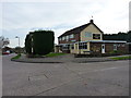
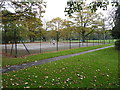
26 photos from this area
Area Information
Key information about the B92 8PA including its size, population, and administrative classification.
- Area Type
- Postcode
- Area Size
- 1.3 hectares
- Population
- 1524
- Population Density
- 2544 people/km²
House Prices in B92 8PA
45
Properties
£224,824
Average Sold Price
£65,000
Lowest Price
£374,000
Highest Price
Showing 45 properties
| Address | Type | Beds | Baths | Last Sale Price | Last Sale Date | |
|---|---|---|---|---|---|---|
| 14 Lammas Close, Elmdon, Solihull, B92 8PA | Semi-detached | 3 | 1 | £360,000 | Mar 2025 | |
| 40 Lammas Close, Elmdon, Solihull, B92 8PA | Semi-detached | 3 | 1 | £345,000 | Mar 2025 | |
| 27 Lammas Close, Elmdon, Solihull, B92 8PA | Semi-detached | 4 | 2 | £365,000 | Mar 2025 | |
| 19 Lammas Close, Elmdon, Solihull, B92 8PA | Semi-detached | 3 | 1 | £305,000 | Feb 2025 | |
| 44 Lammas Close, Elmdon, Solihull, B92 8PA | Semi-detached | 4 | 2 | £374,000 | Aug 2024 | |
| 26 Lammas Close, Elmdon, Solihull, B92 8PA | Semi-detached | 3 | 1 | £330,000 | Jul 2024 | |
| 15 Lammas Close, Elmdon, Solihull, B92 8PA | Semi-detached | 3 | 1 | £333,000 | Jul 2022 | |
| 41 Lammas Close, Elmdon, Solihull, B92 8PA | house | - | - | £305,000 | Feb 2022 | |
| 36 Lammas Close, Elmdon, Solihull, B92 8PA | Semi-detached | 3 | 1 | £285,000 | Sep 2020 | |
| 16 Lammas Close, Elmdon, Solihull, B92 8PA | Semi-detached | 3 | 1 | £270,000 | Sep 2020 |
Page 1 of 5
Energy Efficiency in B92 8PA
Amenities
Schools
| Rank | School | Type | Entry gender | Ages |
|---|
Explore more schools in this area
Go to Schools tabDemographics
Household Size
Family (3-5 people)
most common
Accommodation Type
Houses
most common
Tenure
71
majority
Ethnic Group
White
most common
Religion
N/A
most common
Household Composition
N/A
most common
Age
47
median
Adults (30-64 years)
most common
Household Deprivation
N/A
with no deprivation
NS-SEC
32
in Lower managerial occupations
Explore more demographic insights in this area
Go to Demographics tabPlanning
Planning Constraints
- Flood RiskPremium
- Ramsar Wetland SitesPremium
- Area of Outstanding Natural BeautyPremium
- Protected Nature ReservePremium
- Protected WoodlandPremium