Area Overview for B92 8ES
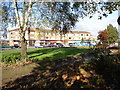
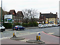
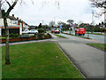
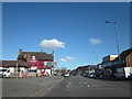
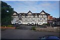
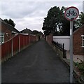
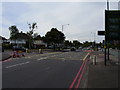
Photos of B92 8ES


Area Information
B92 8ES is a small, residential postcode cluster in England, nestled within the Metropolitan Borough of Solihull. With a population of 1,452, it is a compact area characterised by its proximity to Coventry Road and the surrounding urban landscape. The community here is defined by its mix of established housing and local amenities, offering a blend of convenience and tranquility. Residents benefit from nearby retail outlets such as M&S Sheldon and Asda Hobs, as well as rail access through Olton and Acocks Green stations, which connect to Birmingham and beyond. The area’s low flood risk and below-average crime score of 83/100 contribute to a sense of security. While the postcode itself is small, its strategic location near Birmingham International Airport and major motorway networks ensures easy access to regional hubs. For those seeking a balance between suburban living and urban connectivity, B92 8ES presents a practical choice, with its distinct identity rooted in the broader Lyndon ward.
- Area Type
- Postcode
- Area Size
- Not available
- Population
- 1452
- Population Density
- 6520 people/km²
The property market in B92 8ES is predominantly owner-occupied, with 81% of homes owned by residents rather than rented. This suggests a stable, long-term community with a focus on private residence. The area is characterised by houses rather than flats or apartments, which is typical of suburban and semi-rural settings. Given the small size of the postcode, the housing stock is limited, and buyers may need to consider nearby areas for a broader selection. The high home ownership rate indicates strong local attachment, but it also means the market could be less dynamic compared to regions with higher rental activity. For those seeking a home in B92 8ES, the emphasis on houses may appeal to families or individuals prioritising space and privacy. However, the limited number of properties available within the postcode itself means that proximity to nearby wards or towns like Solihull could be necessary for a wider range of options.
House Prices in B92 8ES
No properties found in this postcode.
Energy Efficiency in B92 8ES
Living in B92 8ES offers access to a range of amenities within practical reach. The retail landscape includes major stores such as M&S Sheldon, Iceland Sheldon, and Asda Hobs, providing everyday shopping convenience. For transport, the area is served by five rail stations, including Olton Railway Station and Acocks Green Railway Station, which connect to Birmingham and beyond. Nearby, Birmingham International Airport and Corporation Street add to the region’s accessibility. Recreational options include Olton Jubilee Park, a green space with historical ties to the area’s Anglo-Saxon heritage. The presence of local pubs and schools retaining the “Lyndon” name suggests a tight-knit community with a sense of place. While the area is small, its proximity to larger urban centres means residents can enjoy both local charm and regional opportunities. The mix of retail, transport, and green space supports a balanced lifestyle, blending practicality with community character.
Amenities
Schools
| Rank | School | Type | Entry gender | Ages |
|---|
Explore more schools in this area
Go to Schools tabDemographics
The population of B92 8ES is predominantly middle-aged, with a median age of 47 and the most common age range being adults aged 30–64. Home ownership is high, with 81% of residents owning their homes, reflecting a stable community. The area is primarily composed of houses, and the predominant ethnic group is White, accounting for 76% of the population. However, the area has seen significant demographic growth, with a 24% increase in ethnic minority residents between 2011 and 2021, largely driven by Asian and Asian British communities. This shift indicates a growing cultural diversity, though the area remains relatively homogenous compared to other parts of Solihull. The high home ownership rate suggests a long-term presence of residents, while the age profile indicates a mature, settled population. The 49th percentile ranking for deprivation nationally means that while the area is not among the most disadvantaged, it faces challenges typical of urban residential zones, such as limited green space and socio-economic divides.
Household Size
Accommodation Type
Tenure
Ethnic Group
Religion
Household Composition
Age
Household Deprivation
NS-SEC
Explore more demographic insights in this area
Go to Demographics tabPlanning
Planning Constraints
- Flood RiskPremium
- Ramsar Wetland SitesPremium
- Area of Outstanding Natural BeautyPremium
- Protected Nature ReservePremium
- Protected WoodlandPremium