Area Overview for B92 8AP
Photos of B92 8AP
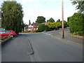
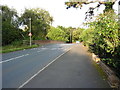
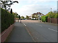
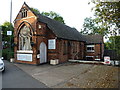
35 photos from this area
Area Information
Key information about the B92 8AP including its size, population, and administrative classification.
- Area Type
- Postcode
- Area Size
- 1.2 hectares
- Population
- 1576
- Population Density
- 4592 people/km²
House Prices in B92 8AP
22
Properties
£295,318
Average Sold Price
£111,000
Lowest Price
£510,000
Highest Price
Showing 22 properties
| Address | Type | Beds | Baths | Last Sale Price | Last Sale Date | |
|---|---|---|---|---|---|---|
| 12 The Close, Olton, Solihull, B92 8AP | Semi-detached | 3 | 2 | £450,000 | Mar 2025 | |
| 8 The Close, Olton, Solihull, B92 8AP | house | - | - | £510,000 | Aug 2023 | |
| 13 The Close, Olton, Solihull, B92 8AP | Semi-detached | 3 | - | £451,500 | Jul 2022 | |
| 10 The Close, Olton, Solihull, B92 8AP | Semi-detached | 3 | 1 | £395,000 | Jan 2021 | |
| 15 The Close, Olton, Solihull, B92 8AP | house | - | - | £405,000 | Feb 2017 | |
| 17 The Close, Olton, Solihull, B92 8AP | house | - | - | £272,000 | Dec 2013 | |
| 18 The Close, Olton, Solihull, B92 8AP | house | - | - | £325,000 | Feb 2012 | |
| 14 The Close, Olton, Solihull, B92 8AP | Semi-detached | - | - | £290,000 | Jul 2007 | |
| 2 The Close, Olton, Solihull, B92 8AP | Semi-detached | - | - | £257,950 | Jun 2007 | |
| 1 The Close, Olton, Solihull, B92 8AP | Semi-detached | 3 | 1 | £250,000 | Nov 2004 |
Page 1 of 3
Energy Efficiency in B92 8AP
Amenities
Schools
| Rank | School | Type | Entry gender | Ages |
|---|
Explore more schools in this area
Go to Schools tabDemographics
Household Size
Family (3-5 people)
most common
Accommodation Type
Houses
most common
Tenure
94
majority
Ethnic Group
White
most common
Religion
N/A
most common
Household Composition
N/A
most common
Age
47
median
Adults (30-64 years)
most common
Household Deprivation
N/A
with no deprivation
NS-SEC
51
in Lower managerial occupations
Explore more demographic insights in this area
Go to Demographics tabPlanning
Planning Constraints
- Flood RiskPremium
- Ramsar Wetland SitesPremium
- Area of Outstanding Natural BeautyPremium
- Protected Nature ReservePremium
- Protected WoodlandPremium