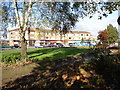
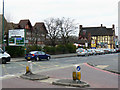
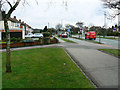
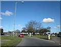
Area Overview for B92 7QZ
Photos of B92 7QZ


Area Information
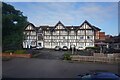
B92 7QZ is a small residential postcode area in England, home to 1,520 people. It sits within a compact cluster of homes, reflecting its modest size and focused character. The area is part of a broader urban landscape, with proximity to key transport links and amenities. Daily life here is shaped by its residential nature, with a mix of local shops, schools, and public transport options within reach. While the population is relatively small, the area’s accessibility to Birmingham and surrounding infrastructure makes it a practical choice for those seeking a balance between suburban living and urban connectivity. The postcode’s location, though unassuming, benefits from proximity to major roads and rail networks, which support both commuting and regional travel. For those considering a home in B92 7QZ, the area offers a straightforward, no-frills lifestyle with a focus on practicality and proximity to essential services. Its compact nature means that residents can access most amenities within a short distance, avoiding the sprawl of larger towns. The area’s appeal lies in its simplicity—few distractions, clear purpose, and a community feel that is neither overly dense nor isolated.
- Area Type
- Postcode
- Area Size
- Not available
- Population
- 1520
- Population Density
- 3363 people/km²
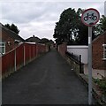
B92 7QZ is predominantly an owner-occupied area, with 84% of homes owned by residents rather than rented. The accommodation type is exclusively houses, which contrasts with areas where flats or apartments dominate. This suggests a focus on family homes and long-term residency, with properties likely designed for multi-generational living or larger households. The high home ownership rate may indicate a stable property market with limited rental demand, though the small size of the area means the housing stock is not extensive. For buyers, this means a limited selection of properties, but also potentially fewer competing interests. The presence of houses rather than flats may appeal to those seeking space and privacy, though it also means the area is unlikely to attract younger, first-time buyers looking for smaller, more affordable units. The market here is likely to be competitive for those seeking a home, given the low population and limited availability of properties.
House Prices in B92 7QZ
No properties found in this postcode.
Energy Efficiency in B92 7QZ
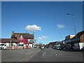
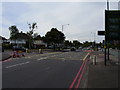
The lifestyle in B92 7QZ is shaped by its proximity to essential amenities. Within practical reach are five retail outlets, including Co-op Lyndon, Tesco Sheldon, and Aldi Lyndon, ensuring everyday shopping needs are met without long trips. The area’s rail network is extensive, with five stations offering connections to Birmingham and surrounding areas. Nearby metro points, such as Birmingham International Airport and Corporation Street, further expand travel options. While the data does not list parks or leisure facilities explicitly, the area’s small size suggests a compact, walkable environment where services are close. The presence of multiple retail and transport hubs indicates a focus on convenience, allowing residents to access shops, dining, and transport links efficiently. This makes B92 7QZ suitable for those prioritizing accessibility over sprawling leisure options, with daily life centered around practicality and ease of movement.
Amenities
Schools
The nearest school to B92 7QZ is Lyndon School, which operates as both a primary school and an academy. The academy branch holds a good Ofsted rating, indicating a solid standard of education. This dual structure provides families with options for both early years education and secondary schooling, though no other schools are listed in the data. The presence of a primary school within the area ensures that younger children can attend local education without long commutes. The academy’s good rating suggests a focus on academic achievement and possibly broader extracurricular opportunities. However, the absence of additional schools or specific details about curriculum or facilities means that families may need to look beyond the immediate postcode for secondary education options. The mix of school types offers flexibility but does not provide a comprehensive range of educational institutions.
| Rank | School | Type | Entry gender | Ages |
|---|
Explore more schools in this area
Go to Schools tabDemographics
The population of B92 7QZ is predominantly adults aged 30–64, with a median age of 47. This suggests a mature, stable community, likely with a strong presence of families and professionals in their middle years. Home ownership is high, at 84%, indicating a long-term commitment to the area. The accommodation type is primarily houses, which aligns with the demographic profile of established residents. The predominant ethnic group is White, with no specific data provided on minority representation, though broader regional trends suggest diversity is growing. The area’s age profile and home ownership rates imply a low turnover of residents, fostering a sense of continuity. However, the absence of detailed data on deprivation or income levels means that quality of life factors beyond ownership and age remain unspecified. The demographic makeup suggests a community that values stability, with fewer transient populations compared to more urban or rapidly developing areas.
Household Size
Accommodation Type
Tenure
Ethnic Group
Religion
Household Composition
Age
Household Deprivation
NS-SEC
Explore more demographic insights in this area
Go to Demographics tabPlanning
Planning Constraints
- Flood RiskPremium
- Ramsar Wetland SitesPremium
- Area of Outstanding Natural BeautyPremium
- Protected Nature ReservePremium
- Protected WoodlandPremium