Area Overview for B92 7PS
Photos of B92 7PS
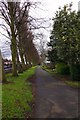
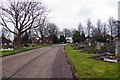
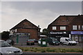
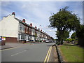
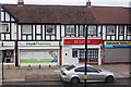
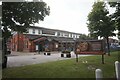
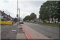
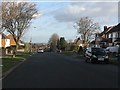
19 photos from this area
Area Information
Key information about the B92 7PS including its size, population, and administrative classification.
- Area Type
- Postcode
- Area Size
- 1.2 hectares
- Population
- 1553
- Population Density
- 4459 people/km²
House Prices in B92 7PS
42
Properties
£165,552
Average Sold Price
£31,400
Lowest Price
£300,000
Highest Price
Showing 42 properties
| Address | Type | Beds | Baths | Last Sale Price | Last Sale Date | |
|---|---|---|---|---|---|---|
| 112 Marcot Road, Solihull, B92 7PS | house | 3 | 1 | £300,000 | Sep 2025 | |
| 106 Marcot Road, Solihull, B92 7PS | Semi-detached | 3 | 1 | £283,000 | Aug 2025 | |
| 132 Marcot Road, Solihull, B92 7PS | Bungalow | 3 | 1 | £260,000 | Dec 2024 | |
| 128 Marcot Road, Solihull, B92 7PS | Semi-detached | 3 | 1 | £285,000 | Oct 2022 | |
| 142 Marcot Road, Solihull, B92 7PS | Retail | 2 | 1 | £221,000 | Apr 2022 | |
| 108 Marcot Road, Solihull, B92 7PS | house | - | - | £212,000 | Sep 2021 | |
| 164 Marcot Road, Solihull, B92 7PS | house | - | - | £207,500 | Apr 2021 | |
| 96 Marcot Road, Solihull, B92 7PS | house | - | - | £237,000 | Feb 2021 | |
| 146 Marcot Road, Solihull, B92 7PS | Semi-detached | 2 | 1 | £224,000 | Sep 2020 | |
| 136 Marcot Road, Solihull, B92 7PS | Semi-detached | 4 | 1 | £240,000 | Aug 2020 |
Page 1 of 5
Energy Efficiency in B92 7PS
Amenities
Schools
| Rank | School | Type | Entry gender | Ages |
|---|
Explore more schools in this area
Go to Schools tabDemographics
Household Size
Two person
most common
Accommodation Type
Houses
most common
Tenure
88
majority
Ethnic Group
White
most common
Religion
N/A
most common
Household Composition
N/A
most common
Age
47
median
Adults (30-64 years)
most common
Household Deprivation
N/A
with no deprivation
NS-SEC
33
in Lower managerial occupations
Explore more demographic insights in this area
Go to Demographics tabPlanning
Planning Constraints
- Flood RiskPremium
- Ramsar Wetland SitesPremium
- Area of Outstanding Natural BeautyPremium
- Protected Nature ReservePremium
- Protected WoodlandPremium