Area Overview for B92 7NX
Photos of B92 7NX
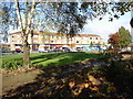
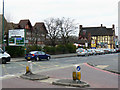
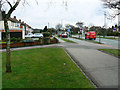
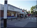
23 photos from this area
Area Information
Key information about the B92 7NX including its size, population, and administrative classification.
- Area Type
- Postcode
- Area Size
- 7261 m²
- Population
- 1452
- Population Density
- 6520 people/km²
House Prices in B92 7NX
13
Properties
£217,900
Average Sold Price
£118,500
Lowest Price
£355,000
Highest Price
Showing 13 properties
| Address | Type | Beds | Baths | Last Sale Price | Last Sale Date | |
|---|---|---|---|---|---|---|
| 12 Coverdale Road, Solihull, B92 7NX | Semi-detached | 4 | 2 | £355,000 | Aug 2019 | |
| 7 Coverdale Road, Solihull, B92 7NX | house | 3 | - | £211,500 | Oct 2014 | |
| 9 Coverdale Road, Solihull, B92 7NX | house | 3 | - | £175,000 | Nov 2012 | |
| 14 Coverdale Road, Solihull, B92 7NX | house | - | - | £245,000 | Jan 2010 | |
| 6 Coverdale Road, Solihull, B92 7NX | house | - | - | £170,000 | Dec 2009 | |
| 3 Coverdale Road, Solihull, B92 7NX | house | - | - | £305,000 | Jul 2009 | |
| 1 Coverdale Road, Solihull, B92 7NX | Semi-detached | 3 | 1 | £230,000 | Jul 2008 | |
| 2 Coverdale Road, Solihull, B92 7NX | Semi-detached | 3 | - | £241,000 | Jul 2007 | |
| 5 Coverdale Road, Solihull, B92 7NX | Semi-detached | 3 | 1 | £128,000 | Sep 2000 | |
| 8 Coverdale Road, Solihull, B92 7NX | Semi-detached | 3 | 2 | £118,500 | Dec 1999 |
Page 1 of 2
Energy Efficiency in B92 7NX
Amenities
Schools
| Rank | School | Type | Entry gender | Ages |
|---|
Explore more schools in this area
Go to Schools tabDemographics
Household Size
Family (3-5 people)
most common
Accommodation Type
Houses
most common
Tenure
81
majority
Ethnic Group
White
most common
Religion
N/A
most common
Household Composition
N/A
most common
Age
47
median
Adults (30-64 years)
most common
Household Deprivation
N/A
with no deprivation
NS-SEC
29
in Lower managerial occupations
Explore more demographic insights in this area
Go to Demographics tabPlanning
Planning Constraints
- Flood RiskPremium
- Ramsar Wetland SitesPremium
- Area of Outstanding Natural BeautyPremium
- Protected Nature ReservePremium
- Protected WoodlandPremium