Area Overview for B92 7LU
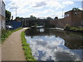
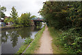
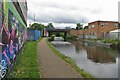
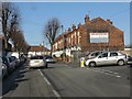
Photos of B92 7LU


Area Information
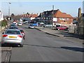
B92 7LU is a small residential postcode in England, home to around 1,520 people. Situated in the urban west of Solihull, it lies south of Coventry Road, bordered by Lode Lane and Hobs Moat Road. The area is part of Lyndon, a district with a distinct character shaped by its Anglo-Saxon origins and historical ties to the Lyndon family. While the population density here is among the highest in Solihull’s wards, the community is compact, with a mix of socio-economic profiles. Daily life is defined by proximity to local amenities, including schools, retail outlets, and transport links. The area’s small size means residents often interact with nearby wards, creating a tightly knit environment. With a median age of 47 and a population skewed toward adults aged 30–64, the community is stable, with a strong focus on family-oriented living. The presence of Lyndon School, both primary and academy, underscores the area’s commitment to education, while the surrounding infrastructure ensures practical connectivity for work and leisure.
- Area Type
- Postcode
- Area Size
- Not available
- Population
- 1520
- Population Density
- 3363 people/km²
B92 7LU is a predominantly owner-occupied area, with 84% of homes owned by residents rather than rented. The accommodation type is largely houses, which is unusual for urban areas and suggests a mix of semi-detached and detached properties. This housing stock caters to families and individuals seeking stability, though the small size of the postcode means the market is limited. Buyers should consider nearby wards for a broader range of options. The high home ownership rate indicates a community of long-term residents, which can influence property values and demand. However, the lack of rental properties may make the area less attractive to those seeking flexibility. For those interested in B92 7LU, the focus on houses means properties are likely to be spacious, though the limited supply could lead to competition. Prospective buyers should also factor in the area’s proximity to amenities and transport links when evaluating the market.
House Prices in B92 7LU
No properties found in this postcode.
Energy Efficiency in B92 7LU
Living in B92 7LU offers a blend of practical amenities and community-focused spaces. Residents have access to five retail outlets, including Co-op Lyndon, Tesco Sheldon, and Aldi Lyndon, ensuring everyday shopping needs are met. The area’s proximity to rail stations—Olton, Acocks Green, and Spring Road—provides reliable public transport links to Birmingham and beyond. Nearby, Birmingham International Airport and Corporation Street add to the area’s connectivity. For leisure, Olton Jubilee Park, once the site of Lyndon Manor, offers green space for recreation. The presence of pubs and schools retaining the ‘Lyndon’ name adds to the area’s distinct character. These amenities collectively support a lifestyle that balances convenience with a sense of local identity, making daily life in B92 7LU both functional and rooted in community.
Amenities
Schools
The nearest schools to B92 7LU include Lyndon School, which operates as both a primary school and an academy. The academy has an Ofsted rating of ‘good’, reflecting its performance in education and student outcomes. The presence of both primary and academy schools provides families with options for their children’s education, from early years through to secondary schooling. The Lyndon School’s dual role suggests a well-established educational infrastructure in the area. For parents, this mix of school types can be advantageous, offering continuity in education or the ability to choose between different teaching approaches. The ‘good’ rating for the academy indicates that the school meets quality standards, though prospective families should consider visiting to assess whether the school aligns with their priorities. The proximity of these schools to homes in B92 7LU enhances the area’s appeal for families.
| Rank | School | Type | Entry gender | Ages |
|---|
Explore more schools in this area
Go to Schools tabDemographics
The population of B92 7LU is predominantly adults aged 30–64, with a median age of 47. Home ownership is high, at 84%, reflecting a community of long-term residents. The accommodation type is primarily houses, indicating a low-density residential character. The predominant ethnic group is White, making up 76% of the population, though 24% identify as ethnic minorities, with a notable 80% growth in this group between 2011 and 2021. This demographic shift has influenced the area’s social fabric, though it remains distinct from the broader Solihull borough. The high home ownership rate suggests a settled population, while the mix of ethnic backgrounds adds diversity to local culture. However, the area ranks around the 49th percentile nationally for deprivation, which may affect access to certain services or opportunities. This context is important for understanding the lived experience of residents, particularly in terms of economic stability and community resources.
Household Size
Accommodation Type
Tenure
Ethnic Group
Religion
Household Composition
Age
Household Deprivation
NS-SEC
Explore more demographic insights in this area
Go to Demographics tabPlanning
Planning Constraints
- Flood RiskPremium
- Ramsar Wetland SitesPremium
- Area of Outstanding Natural BeautyPremium
- Protected Nature ReservePremium
- Protected WoodlandPremium