Area Overview for B92 7HE
Photos of B92 7HE
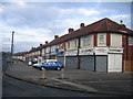
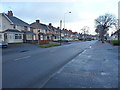
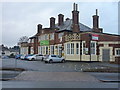
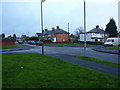


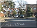

17 photos from this area
Area Information
Key information about the B92 7HE including its size, population, and administrative classification.
- Area Type
- Postcode
- Area Size
- 9.1 hectares
- Population
- 1685
- Population Density
- 4044 people/km²
House Prices in B92 7HE
57
Properties
£184,711
Average Sold Price
£59,000
Lowest Price
£330,000
Highest Price
Showing 57 properties
| Address | Type | Beds | Baths | Last Sale Price | Last Sale Date | |
|---|---|---|---|---|---|---|
| 62 Langley Hall Road, Olton, Solihull, B92 7HE | Detached | 3 | 2 | £288,000 | Aug 2025 | |
| 67 Langley Hall Road, Olton, Solihull, B92 7HE | house | - | - | £292,000 | Jan 2025 | |
| 56 Langley Hall Road, Olton, Solihull, B92 7HE | Semi-detached | 3 | 2 | £325,000 | Jul 2024 | |
| 39 Langley Hall Road, Olton, Solihull, B92 7HE | Maisonette | 2 | 1 | £180,000 | Jun 2024 | |
| 25 Langley Hall Road, Olton, Solihull, B92 7HE | Maisonette | 2 | 2 | £165,000 | Nov 2023 | |
| 49 Langley Hall Road, Olton, Solihull, B92 7HE | Maisonette | 2 | 1 | £180,000 | Oct 2023 | |
| 43 Langley Hall Road, Olton, Solihull, B92 7HE | Maisonette | 2 | 1 | £199,950 | Aug 2023 | |
| 92 Langley Hall Road, Olton, Solihull, B92 7HE | house | - | - | £330,000 | Feb 2023 | |
| 64 Langley Hall Road, Olton, Solihull, B92 7HE | Semi-detached | 3 | - | £300,000 | Dec 2022 | |
| 52 Langley Hall Road, Olton, Solihull, B92 7HE | house | 3 | 1 | £280,000 | Mar 2022 |
Page 1 of 6
Energy Efficiency in B92 7HE
Amenities
Schools
| Rank | School | Type | Entry gender | Ages |
|---|
Explore more schools in this area
Go to Schools tabDemographics
Household Size
Family (3-5 people)
most common
Accommodation Type
Houses
most common
Tenure
77
majority
Ethnic Group
White
most common
Religion
N/A
most common
Household Composition
N/A
most common
Age
47
median
Adults (30-64 years)
most common
Household Deprivation
N/A
with no deprivation
NS-SEC
37
in Lower managerial occupations
Explore more demographic insights in this area
Go to Demographics tabPlanning
Planning Constraints
- Flood RiskPremium
- Ramsar Wetland SitesPremium
- Area of Outstanding Natural BeautyPremium
- Protected Nature ReservePremium
- Protected WoodlandPremium