Area Overview for B92 7BP
Photos of B92 7BP
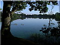


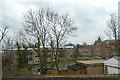
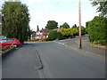
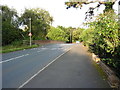
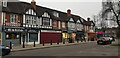
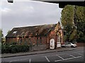
35 photos from this area
Area Information
Key information about the B92 7BP including its size, population, and administrative classification.
- Area Type
- Postcode
- Area Size
- 1.8 hectares
- Population
- 1720
- Population Density
- 3242 people/km²
House Prices in B92 7BP
16
Properties
£518,063
Average Sold Price
£122,750
Lowest Price
£1,250,000
Highest Price
Showing 16 properties
| Address | Type | Beds | Baths | Last Sale Price | Last Sale Date | |
|---|---|---|---|---|---|---|
| 88 St Bernards Road, Olton, Solihull, B92 7BP | Retail | 7 | - | £1,250,000 | Jul 2022 | |
| 70D, Avon Court, St Bernards Road, Olton, Solihull, B92 7BP | Flat | - | - | £166,000 | Feb 2021 | |
| 86 St Bernards Road, Olton, Solihull, B92 7BP | Detached | 7 | 2 | £912,500 | Feb 2021 | |
| 70, Avon Court, St Bernards Road, Olton, Solihull, B92 7BP | Flat | 2 | 1 | £145,000 | Sep 2018 | |
| 70B, Avon Court, St Bernards Road, Olton, Solihull, B92 7BP | Flat | - | - | £173,000 | Oct 2016 | |
| 70C, Avon Court, St Bernards Road, Olton, Solihull, B92 7BP | Flat | - | - | £167,500 | Jul 2015 | |
| 78A St Bernards Road, Olton, Solihull, B92 7BP | house | - | - | £690,000 | Apr 2013 | |
| 82 St Bernards Road, Olton, Solihull, B92 7BP | house | 8 | - | £1,130,000 | Jun 2010 | |
| 70E, Avon Court, St Bernards Road, Olton, Solihull, B92 7BP | Flat | 2 | 1 | £122,750 | Mar 2010 | |
| 84 St Bernards Road, Olton, Solihull, B92 7BP | house | - | - | £610,000 | Nov 2007 |
Page 1 of 2
Energy Efficiency in B92 7BP
Amenities
Schools
| Rank | School | Type | Entry gender | Ages |
|---|
Explore more schools in this area
Go to Schools tabDemographics
Household Size
Two person
most common
Accommodation Type
Houses
most common
Tenure
79
majority
Ethnic Group
White
most common
Religion
N/A
most common
Household Composition
N/A
most common
Age
47
median
Adults (30-64 years)
most common
Household Deprivation
N/A
with no deprivation
NS-SEC
49
in Lower managerial occupations
Explore more demographic insights in this area
Go to Demographics tabPlanning
Planning Constraints
- Flood RiskPremium
- Ramsar Wetland SitesPremium
- Area of Outstanding Natural BeautyPremium
- Protected Nature ReservePremium
- Protected WoodlandPremium