Area Overview for B92 7AE
Photos of B92 7AE
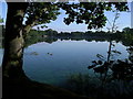

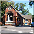
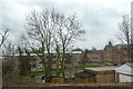
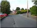
35 photos from this area
Area Information
Key information about the B92 7AE including its size, population, and administrative classification.
- Area Type
- Postcode
- Area Size
- 3.2 hectares
- Population
- 1572
- Population Density
- 2963 people/km²
House Prices in B92 7AE
39
Properties
£305,224
Average Sold Price
£80,000
Lowest Price
£600,000
Highest Price
Showing 39 properties
| Address | Type | Beds | Baths | Last Sale Price | Last Sale Date | |
|---|---|---|---|---|---|---|
| 204 Warwick Road, Olton, Solihull, B92 7AE | Semi-detached | 6 | 5 | £465,000 | Jul 2024 | |
| 212 Warwick Road, Olton, Solihull, B92 7AE | Semi-detached | 3 | 1 | £255,000 | Nov 2023 | |
| 254 Warwick Road, Olton, Solihull, B92 7AE | Detached | - | - | £250,540 | Sep 2022 | |
| 256 Warwick Road, Olton, Solihull, B92 7AE | Retail | 4 | 2 | £600,000 | Jul 2022 | |
| 224 Warwick Road, Olton, Solihull, B92 7AE | Retail | 4 | 1 | £500,000 | Apr 2022 | |
| 234 Warwick Road, Olton, Solihull, B92 7AE | Semi-detached | 4 | - | £465,000 | Sep 2021 | |
| 246 Warwick Road, Olton, Solihull, B92 7AE | house | - | - | £492,000 | Oct 2020 | |
| 236 Warwick Road, Olton, Solihull, B92 7AE | house | - | - | £360,000 | Jun 2019 | |
| 214 Warwick Road, Olton, Solihull, B92 7AE | Semi-detached | 3 | 1 | £303,500 | Mar 2019 | |
| 268 Warwick Road, Olton, Solihull, B92 7AE | house | - | - | £390,000 | Jul 2018 |
Page 1 of 4
Energy Efficiency in B92 7AE
Amenities
Schools
| Rank | School | Type | Entry gender | Ages |
|---|
Explore more schools in this area
Go to Schools tabDemographics
Household Size
One person
most common
Accommodation Type
Flats
most common
Tenure
80
majority
Ethnic Group
White
most common
Religion
N/A
most common
Household Composition
N/A
most common
Age
47
median
Adults (30-64 years)
most common
Household Deprivation
N/A
with no deprivation
NS-SEC
44
in Lower managerial occupations
Explore more demographic insights in this area
Go to Demographics tabPlanning
Planning Constraints
- Flood RiskPremium
- Ramsar Wetland SitesPremium
- Area of Outstanding Natural BeautyPremium
- Protected Nature ReservePremium
- Protected WoodlandPremium