Area Overview for B92 0BA
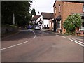
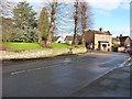
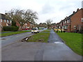
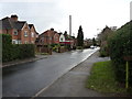
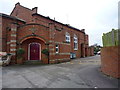
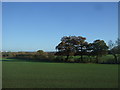
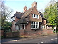
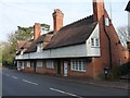
Photos of B92 0BA


Area Information
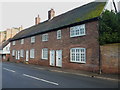
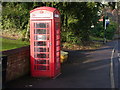
Living in B92 0BA means inhabiting a small, tightly knit residential cluster in the West Midlands, nestled within the Solihull borough. With a population of 2,169 and a density of 187 people per square kilometre, this area balances quiet suburban living with historical depth. Situated in the Meriden Gap, a corridor of countryside between Solihull and Coventry, B92 0BA has roots stretching back to the Domesday Book, when it was known as Hamtone. Its character is shaped by its position on the historic salt route, linking Droitwich to Coventry. Today, the area retains a village feel, with landmarks like the medieval Packhorse Bridge and St Andrew’s Church standing as testaments to its past. Proximity to Birmingham International Airport and multiple railway stations, including Hampton and Berkswell, ensures easy access to urban centres. For residents, daily life blends traditional charm with modern convenience, from local shops to schools rated outstanding by Ofsted. The low crime score and minimal environmental constraints make it a practical choice for those seeking stability without sacrificing historical interest.
- Area Type
- Postcode
- Area Size
- Not available
- Population
- 2169
- Population Density
- 187 people/km²
The property market in B92 0BA is defined by high home ownership (83%) and a predominance of houses. This suggests a largely owner-occupied area with limited rental activity, which can make the market less dynamic but more predictable for buyers. The focus on houses rather than flats or apartments reflects the suburban nature of the area, offering more space and privacy compared to denser urban settings. Given the small population and low density, the housing stock is likely limited, meaning buyers may need to consider nearby areas for more options. The high home ownership rate also indicates strong community ties, with many residents having lived in the area for years. For prospective buyers, this environment may appeal to those seeking a stable, family-friendly setting with established properties, though competition for available homes could be fierce due to the area’s appeal.
House Prices in B92 0BA
No properties found in this postcode.
Energy Efficiency in B92 0BA
The lifestyle in B92 0BA is shaped by its proximity to essential amenities. Residents have access to five retail outlets, including Asda Bickenhill and Spar, offering everyday shopping convenience. The area’s rail network, with stations like Hampton and Berkswell, connects to Birmingham and surrounding towns, while Birmingham International Airport is a short distance away. For leisure, the nearby historic landmarks, such as St Andrew’s Church and the Packhorse Bridge, provide cultural enrichment. The low crime rate and absence of environmental constraints contribute to a relaxed, community-focused atmosphere. However, the limited number of dining or entertainment venues suggests a more subdued social scene compared to larger towns. Overall, the area balances practicality with a touch of heritage, ideal for those prioritising safety, convenience, and historical interest over bustling urban amenities.
Amenities
Schools
Residents of B92 0BA have access to two notable schools. George Fentham Endowed School is a primary school with an outstanding Ofsted rating, offering high-quality education for younger children. The Island Project School, a special school with a good Ofsted rating, caters to students with specific educational needs. This mix of school types provides families with options for both mainstream and specialist education. The presence of an outstanding primary school is a significant advantage, ensuring children receive a strong foundation in early years. The special school adds value for families requiring tailored support, though it may not serve all needs. Together, these institutions reflect a commitment to education within the community, though parents should consider proximity and catchment areas when evaluating the schools’ accessibility.
| Rank | School | Type | Entry gender | Ages |
|---|
Explore more schools in this area
Go to Schools tabDemographics
The community in B92 0BA is predominantly composed of adults aged 30–64, with a median age of 47. This suggests a mature, established population, likely with long-term ties to the area. Home ownership is high at 83%, indicating a stable, owner-occupied demographic. The accommodation type is primarily houses, which aligns with the area’s suburban character and lower population density. The predominant ethnic group is White, though no specific data on diversity or deprivation is provided. The age profile implies a community focused on family living, with fewer young children or retirees compared to other areas. The high home ownership rate also suggests a preference for long-term residency over rental properties. This demographic profile supports a quiet, low-traffic environment, ideal for those prioritising stability and a slower pace of life.
Household Size
Accommodation Type
Tenure
Ethnic Group
Religion
Household Composition
Age
Household Deprivation
NS-SEC
Explore more demographic insights in this area
Go to Demographics tabPlanning
Planning Constraints
- Flood RiskPremium
- Ramsar Wetland SitesPremium
- Area of Outstanding Natural BeautyPremium
- Protected Nature ReservePremium
- Protected WoodlandPremium