Area Overview for B91 9DB
Photos of B91 9DB

Area Information
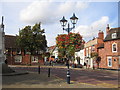
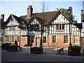
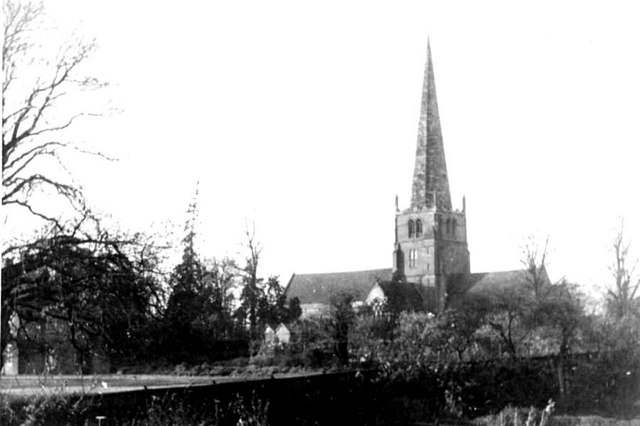
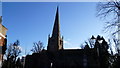
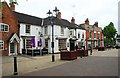
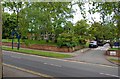
Living in B91 9DB means inhabiting a compact, densely populated postcode area within the historic St Alphege Ward of Solihull. With 1,798 residents spread across a small cluster of homes, the area reflects a mature community, predominantly adults aged 30-64. Its medieval roots are evident in the nearby St Alphege Church, a Grade I listed structure that has anchored the town since the 13th century. Daily life here is shaped by proximity to essential services, including multiple schools, retail outlets, and transport links. The area’s compact size means residents can access amenities like Morrisons Solihull and Solihull Railway Station within short distances. While the housing stock is largely flats, the high home ownership rate of 66% suggests a stable, long-term resident base. B91 9DB sits at the heart of Solihull’s historic trade hub, blending historical character with modern convenience.
- Area Type
- Postcode
- Area Size
- Not available
- Population
- 1798
- Population Density
- 1383 people/km²
The property market in B91 9DB is characterised by a high home ownership rate of 66%, indicating a significant proportion of residents own their homes. The accommodation type is predominantly flats, which is typical for areas with high population density. This suggests a housing stock that caters to both owner-occupiers and renters, though the exact proportion of rental properties is not specified. Given the area’s small size, the property market is likely limited in scale, with limited scope for expansion. Buyers should consider the proximity to schools and transport links, which are key factors in the area’s appeal. The concentration of flats may also mean that property values are influenced more by location and local amenities than by the size or type of individual homes.
House Prices in B91 9DB
No properties found in this postcode.
Energy Efficiency in B91 9DB
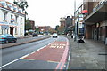
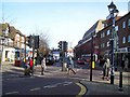
The lifestyle in B91 9DB is shaped by its proximity to retail, dining, and transport hubs. Residents can access major supermarkets like Morrisons Solihull, Sainsburys Solihull, and Tesco Solihull, ensuring everyday shopping needs are met locally. The area’s rail network, including Solihull Railway Station and Widney Manor, connects to broader transport systems, while Birmingham International Airport offers international travel options. Though the data does not mention parks or leisure facilities explicitly, the historical and cultural landmarks like St Alphege Church suggest a community with a strong sense of heritage. The compact layout means amenities are within walking or short driving distance, supporting a convenient, accessible lifestyle.
Amenities
Schools
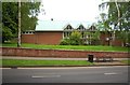
Residents of B91 9DB have access to a range of educational institutions, from primary schools to sixth-form colleges. St Augustine’s Catholic Primary School and St Peter’s Catholic School provide early education, while Malvern Hall School serves primary-aged children. Blossomfield Centre, though categorised as ‘other,’ may offer additional learning or community programmes. For secondary education, Solihull College & University Centre provides sixth-form and higher education opportunities. The mix of school types ensures families can access education at multiple stages without leaving the area. However, the absence of secondary schools within the immediate vicinity means students may need to travel to nearby towns for higher-level education. This diversity of options supports families seeking both religious and secular schooling, though the exact Ofsted ratings for these institutions are not provided in the data.
| Rank | School | Type | Entry gender | Ages |
|---|
Explore more schools in this area
Go to Schools tabDemographics
The population of B91 9DB is 1,798, with a median age of 47, reflecting a community skewed towards middle-aged adults. The most common age range is 30-64 years, indicating a stable, established demographic. Home ownership in the area stands at 66%, with flats being the predominant accommodation type. The predominant ethnic group is White, though specific diversity metrics are not detailed in the data. The high population density of 1,383 people per square kilometre suggests a compact, densely lived-in area. While no deprivation data is provided, the mix of home ownership and rental properties implies a balance between long-term residents and those in transient housing. This profile suggests a community focused on stability, with a majority of residents likely to have lived in the area for several years.
Household Size
Accommodation Type
Tenure
Ethnic Group
Religion
Household Composition
Age
Household Deprivation
NS-SEC
Explore more demographic insights in this area
Go to Demographics tabPlanning
Planning Constraints
- Flood RiskPremium
- Ramsar Wetland SitesPremium
- Area of Outstanding Natural BeautyPremium
- Protected Nature ReservePremium
- Protected WoodlandPremium