Area Overview for B91 9BY
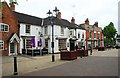
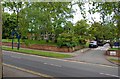
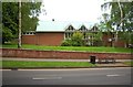
Photos of B91 9BY

Area Information
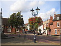
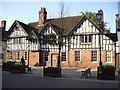
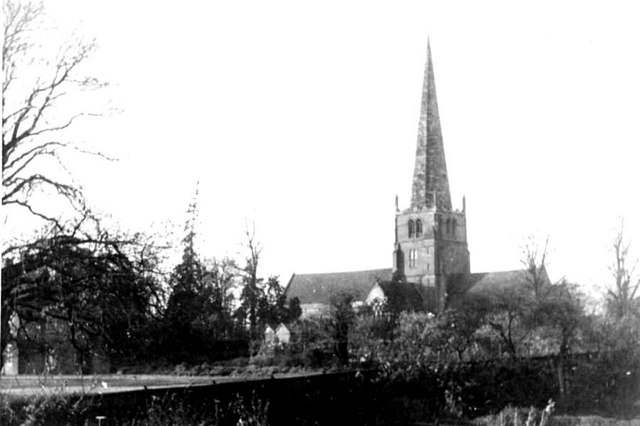
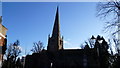
Living in B91 9BY means being part of a tightly knit residential cluster in the heart of Solihull, a town with medieval roots. This postcode area, home to 1,798 people spread across 1.3 km², reflects a community shaped by history and modern convenience. The area’s population density of 1,383 people per square kilometre suggests a compact, urbanised layout, typical of planned medieval settlements. Centred around St Alphege Church, a Grade I listed Gothic structure with a visible 168 ft spire, the area retains historical character while offering contemporary amenities. Residents benefit from proximity to Solihull’s core, with access to retail, transport, and educational hubs. The demographic profile—predominantly adults aged 30–64, with 66% owning their homes—hints at a stable, established community. Daily life here balances historical landmarks like St Alphege Church with practical needs, from nearby supermarkets to rail links. For buyers, B91 9BY represents a blend of heritage and accessibility, though the high crime risk noted in assessments demands careful consideration.
- Area Type
- Postcode
- Area Size
- Not available
- Population
- 1798
- Population Density
- 1383 people/km²
The property market in B91 9BY is defined by a high proportion of flats, with 66% of homes owned by residents rather than rented. This suggests a mix of owner-occupied properties and rental units, though the exact split between the two is not specified. The prevalence of flats indicates a housing stock suited to smaller households or those prioritising ease of maintenance over larger living spaces. Given the area’s compact size and high density, property availability may be limited, particularly for buyers seeking larger homes. The small postcode area’s proximity to Solihull’s amenities—such as retail hubs and transport links—could make it attractive to investors or first-time buyers, though the high crime risk noted in assessments may affect desirability. For those considering purchase, the market reflects a practical, if modest, option within a historically rich town.
House Prices in B91 9BY
No properties found in this postcode.
Energy Efficiency in B91 9BY
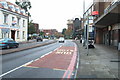
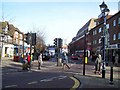
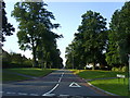
The lifestyle in B91 9BY is shaped by its proximity to retail, dining, and transport hubs. Nearby supermarkets such as Morrisons Solihull, Sainsburys Solihull, and Tesco Solihull provide convenience for daily shopping, while the area’s rail stations offer access to broader leisure opportunities. The historic St Alphege Church and surrounding streets contribute to a distinct character, though parks or green spaces are not explicitly mentioned in the data. Residents can enjoy the town’s medieval heritage alongside modern amenities, from retail centres to transport links. The presence of multiple schools and colleges suggests a family-friendly environment, though the absence of specific details on parks or recreational facilities means their availability remains unclear. Overall, B91 9BY offers a blend of historical charm and practical convenience, ideal for those valuing accessibility over expansive natural landscapes.
Amenities
Schools
Residents of B91 9BY have access to a range of educational institutions, from primary schools to sixth-form colleges. Nearby options include St Augustine’s Catholic Primary School, St Peter’s Catholic School, Malvern Hall School, and Solihull College & University Centre, which offers sixth-form education. The presence of both primary and secondary-level institutions suggests a comprehensive educational ecosystem for families. However, no Ofsted ratings are provided for these schools, so their quality remains unquantified. The mix of faith-based and secular institutions may appeal to parents seeking specific educational philosophies. For those requiring higher education, Solihull College’s proximity offers pathways to further study or vocational training. The availability of multiple schools within practical reach enhances the area’s appeal for families prioritising educational diversity.
| Rank | School | Type | Entry gender | Ages |
|---|
Explore more schools in this area
Go to Schools tabDemographics
B91 9BY’s population skews towards middle-aged adults, with a median age of 47 and 66% of residents owning their homes. The most common age range, 30–64 years, suggests a community of settled families and professionals. Accommodation is predominantly flats, reflecting a housing stock tailored to smaller households or those prioritising convenience over space. The predominant ethnic group is White, though no specific data on diversity or deprivation levels is provided. Home ownership rates imply a degree of stability, though the 66% figure also indicates a significant rental market. This mix may influence local dynamics, with a balance between long-term residents and transient tenants. The absence of detailed diversity metrics means broader societal composition remains unquantified, but the area’s focus on flats and adult demographics points to a practical, functional living environment.
Household Size
Accommodation Type
Tenure
Ethnic Group
Religion
Household Composition
Age
Household Deprivation
NS-SEC
Explore more demographic insights in this area
Go to Demographics tabPlanning
Planning Constraints
- Flood RiskPremium
- Ramsar Wetland SitesPremium
- Area of Outstanding Natural BeautyPremium
- Protected Nature ReservePremium
- Protected WoodlandPremium