Area Overview for B91 9BG
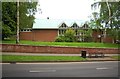
Photos of B91 9BG


Area Information
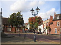
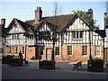
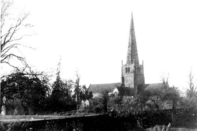
The B91 9BG postcode sits within a small residential cluster near Solihull town centre, characterised by a population of 1,798 residents. This locality operates with a high intensity, recording a population density of 1,383 people per square kilometre. The area functions as a dense urban node where daily life revolves around proximity to key historical and commercial hubs. You are living in a neighbourhood defined by its compact nature, where homes sit close to railway stations and major retail parks. The location benefits from deep historical roots, tracing back to the medieval founding of Solihull as a planned borough between 1170 and 1180 by the de Limsey family. Today, the landscape retains its historic identity, centred around the Grade I listed St Alphege Church on High Street. Residents enjoy excellent access to transport links, with five railway stations nearby, including Solihull and Widney Manor stations. The proximity to Birmingham International Airport adds significant value for commuters and travellers. Daily errands are straightforward, given the concentration of major supermarkets like Morrisons, Sainsburys, and Tesco within practical reach. While the area offers convenience and global connectivity, its high density means a distinctly urban experience rather than a countryside retreat. This postcode serves those who prioritise efficient urban living with direct access to regional employment centres without the isolation often found further out in the West Midlands.
- Area Type
- Postcode
- Area Size
- Not available
- Population
- 1798
- Population Density
- 1383 people/km²
The property market in B91 9BG is defined by a high proportion of owner-occupied homes, with 66% of the population holding a stake in their property. This statistic places the area firmly in the spectrum of established residential zones rather than rental hotspots. You will find flats constitute the predominant accommodation type, a feature consistent with the area's population density of 1,383 people per square kilometre. The housing stock reflects a planned medieval settlement history that has evolved into a modern residential cluster near Solihull's historic core. Only a third of households rent, indicating strong demand for purchasing property in this specific postcode. The concentration of flats suggests a vertical living model common in urban centres, where land value and space efficiency prioritise multi-unit developments over sprawling bungalows. For buyers looking at homes in B91 9BG, the market favours those seeking a diverse range of flat developments rather than single-family detached houses. The area's proximity to St Alphege Ward's historic centre adds a layer of prestige to potential properties, even if the immediate built environment remains dense. Purchasing here means securing a foothold in a community where residents are likely already invested in the area's progress. The high ownership rate implies that local schools and amenities have stable funding and support from a resident base. You can expect a market driven by local improvement rather than speculation. Whether you are buying an existing flat or considering new-build conversions, the 66% ownership figure marks this postcode as a solid choice for long-term investment in Solihull's metropolitan borough.
House Prices in B91 9BG
No properties found in this postcode.
Energy Efficiency in B91 9BG
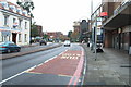
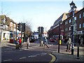
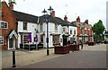
Living in B91 9BG offers immediate access to a wide array of amenities without the need for long journeys. Retail options are diverse, with five notable supermarkets located nearby. Residents can choose between Morrisons Solihull, Sainsburys Solihull, and Tesco Solihull for their weekly shopping requirements. This selection provides flexibility in terms of store loyalty, price comparison, and product range. Transport connectivity further enhances lifestyle convenience, with five railway stations and two major metro hubs within reach. Solihull Railway Station, Widney Manor Railway Station, and Olton Railway Station facilitate easy commutes across the Midlands. For those wishing to travel further afield, Birmingham International Airport and Birmingham International Railway Station offer extensive national and international connections. The proximity of these major hubs means you can manage work commitments and leisure travel without significant disruption to your schedule. The area's historical significance, centred on St Alphege Church, adds a cultural dimension to daily life. Walking past historic landmarks like the Grade I listed church provides a connection to Solihull's medieval heritage while you run errands at local stores. This blend of modern convenience and historical context defines the local lifestyle. You have the freedom to choose your grocery provider while maintaining easy access to national transport networks. The density of amenities ensures that essential services are always within practical reach.
Amenities
Schools
Educational provision near B91 9BG presents a dedicated mix of primary and secondary options for local families. St Augustine's Catholic Primary School and St Peter's Catholic School provide denominational education for primary-aged children. Malvern Hall School serves as another primary option within close proximity. These institutions cover the early years of compulsory education, offering a specific educational philosophy that may appeal to parents seeking faith-based schooling. Beyond primary education, Solihull College & University Centre functions as a sixth-form college, catering to older students preparing for university or vocational training. This configuration creates a continuous educational pathway from early primary years through to post-16 study within the local catchment. The presence of Blossomfield Centre as an additional facility suggests access to extra-curricular or community-based learning environments. This variety means children in B91 9BG rarely need to travel far for their complete education. Parents choosing schools near B91 9BG benefit from a compact educational map. The inclusion of Catholic primary schools indicates a strong local demand for religious instruction. The sixth-form college nearby allows students to remain in the local community while advancing their academic qualifications. Living in B91 9BG ensures that your child's educational journey begins and often ends close to home, with established institutions like St Peter's and Solihull College supporting the local demographic.
| Rank | School | Type | Entry gender | Ages |
|---|
Explore more schools in this area
Go to Schools tabDemographics
The community in B91 9BG reflects a settled, mature population with a median age of 47 years. Adults between the ages of 30 and 64 dominate the age profile, indicating a stable demographic favourable for long-term home ownership and family life. A significant majority of residents, specifically 66%, own their homes outright or with a mortgage. This high rate of ownership suggests that the local housing market is driven by long-term residents rather than short-term renters. The prevailing accommodation type consists of flats, which aligns with the high population density and urban character of the postcode. Diversity remains stable within the ward, with White residents forming the predominant ethnic group. This homogeneity often correlates with established neighbourhoods where social networks are well-formed. The demographic spread suggests a quieter domestic environment compared to areas skewed towards young professionals or students. Families and older couples likely constitute the bulk of the household composition. With nearly two-thirds of households being owner-occupied, the area has matured beyond a transient phase. The age profile supports local businesses that cater to a settled adult demographic, including those seeking libraries, leisure clubs, and educational institutions for their children. Living in B91 9BG offers the stability of a community where people have chosen to put down roots.
Household Size
Accommodation Type
Tenure
Ethnic Group
Religion
Household Composition
Age
Household Deprivation
NS-SEC
Explore more demographic insights in this area
Go to Demographics tabPlanning
Planning Constraints
- Flood RiskPremium
- Ramsar Wetland SitesPremium
- Area of Outstanding Natural BeautyPremium
- Protected Nature ReservePremium
- Protected WoodlandPremium