Area Overview for B91 3SU
Photos of B91 3SU
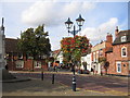


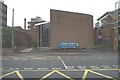
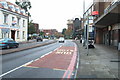
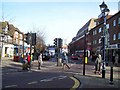

100 photos from this area
Area Information
Key information about the B91 3SU including its size, population, and administrative classification.
- Area Type
- Postcode
- Area Size
- 1.7 hectares
- Population
- 1660
- Population Density
- 1539 people/km²
House Prices in B91 3SU
34
Properties
£222,000
Average Sold Price
£83,000
Lowest Price
£307,000
Highest Price
Showing 34 properties
| Address | Type | Beds | Baths | Last Sale Price | Last Sale Date | |
|---|---|---|---|---|---|---|
| Flat 12, Cedarhurst, Park Road, Solihull, B91 3SU | Flat | - | - | £220,000 | Jul 2025 | |
| Flat 18, Cedarhurst, Park Road, Solihull, B91 3SU | Flat | - | - | £215,000 | May 2025 | |
| Flat 20, Cedarhurst, Park Road, Solihull, B91 3SU | Flat | 2 | 1 | £260,000 | Aug 2024 | |
| Flat 7, Cedarhurst, Park Road, Solihull, B91 3SU | Flat | 2 | 1 | £285,000 | Sep 2022 | |
| Flat 29, Cedarhurst, Park Road, Solihull, B91 3SU | Flat | 2 | 1 | £245,000 | Jun 2022 | |
| Flat 22, Cedarhurst, Park Road, Solihull, B91 3SU | Flat | 2 | 1 | £307,000 | Jun 2018 | |
| Flat 19, Cedarhurst, Park Road, Solihull, B91 3SU | Flat | - | - | £246,000 | Jan 2017 | |
| Flat 31, Cedarhurst, Park Road, Solihull, B91 3SU | Flat | 2 | 1 | £203,000 | Jul 2008 | |
| Flat 1, Cedarhurst, Park Road, Solihull, B91 3SU | Flat | - | - | £156,000 | Nov 2001 | |
| Flat 27, Cedarhurst, Park Road, Solihull, B91 3SU | Flat | 2 | - | £83,000 | Feb 1998 |
Page 1 of 4
Energy Efficiency in B91 3SU
Amenities
Schools
| Rank | School | Type | Entry gender | Ages |
|---|
Explore more schools in this area
Go to Schools tabDemographics
Household Size
One person
most common
Accommodation Type
Houses
most common
Tenure
76
majority
Ethnic Group
White
most common
Religion
N/A
most common
Household Composition
N/A
most common
Age
47
median
Adults (30-64 years)
most common
Household Deprivation
N/A
with no deprivation
NS-SEC
56
in Lower managerial occupations
Explore more demographic insights in this area
Go to Demographics tabPlanning
Planning Constraints
- Flood RiskPremium
- Ramsar Wetland SitesPremium
- Area of Outstanding Natural BeautyPremium
- Protected Nature ReservePremium
- Protected WoodlandPremium