Area Overview for B91 3RW
Photos of B91 3RW
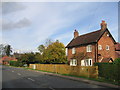
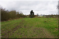
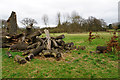
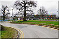
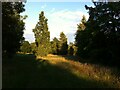
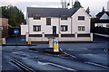
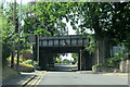
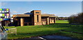
25 photos from this area
Area Information
Key information about the B91 3RW including its size, population, and administrative classification.
- Area Type
- Postcode
- Area Size
- 3.6 hectares
- Population
- 1660
- Population Density
- 1539 people/km²
House Prices in B91 3RW
19
Properties
£394,782
Average Sold Price
£209,000
Lowest Price
£753,000
Highest Price
Showing 19 properties
| Address | Type | Beds | Baths | Last Sale Price | Last Sale Date | |
|---|---|---|---|---|---|---|
| 53 Ladbrook Road, Solihull, B91 3RW | Detached | 4 | 2 | £753,000 | May 2025 | |
| 47 Ladbrook Road, Solihull, B91 3RW | Detached | 4 | 2 | £695,000 | Dec 2023 | |
| 102 Ladbrook Road, Solihull, B91 3RW | Semi-detached | 4 | 1 | £550,000 | Feb 2023 | |
| 82 Ladbrook Road, Solihull, B91 3RW | Semi-detached | 4 | 1 | £485,000 | Dec 2016 | |
| 98 Ladbrook Road, Solihull, B91 3RW | house | - | - | £379,950 | Nov 2013 | |
| 106 Ladbrook Road, Solihull, B91 3RW | house | 3 | - | £316,000 | Aug 2012 | |
| 94 Ladbrook Road, Solihull, B91 3RW | house | 3 | - | £342,000 | Sep 2011 | |
| 114 Ladbrook Road, Solihull, B91 3RW | Semi-detached | - | - | £312,500 | Oct 2007 | |
| 49 Ladbrook Road, Solihull, B91 3RW | Semi-detached | - | - | £333,500 | Jun 2006 | |
| 112 Ladbrook Road, Solihull, B91 3RW | Semi-detached | - | - | £300,000 | Jun 2006 |
Page 1 of 2
Energy Efficiency in B91 3RW
Amenities
Schools
| Rank | School | Type | Entry gender | Ages |
|---|
Explore more schools in this area
Go to Schools tabDemographics
Household Size
One person
most common
Accommodation Type
Houses
most common
Tenure
76
majority
Ethnic Group
White
most common
Religion
N/A
most common
Household Composition
N/A
most common
Age
47
median
Adults (30-64 years)
most common
Household Deprivation
N/A
with no deprivation
NS-SEC
56
in Lower managerial occupations
Explore more demographic insights in this area
Go to Demographics tabPlanning
Planning Constraints
- Flood RiskPremium
- Ramsar Wetland SitesPremium
- Area of Outstanding Natural BeautyPremium
- Protected Nature ReservePremium
- Protected WoodlandPremium