Area Overview for B91 3FL
Photos of B91 3FL
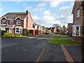
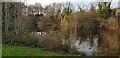
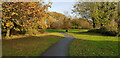
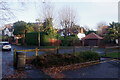
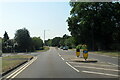
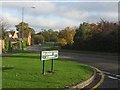
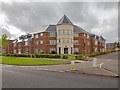
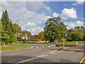
17 photos from this area
Area Information
Key information about the B91 3FL including its size, population, and administrative classification.
- Area Type
- Postcode
- Area Size
- 2.7 hectares
- Population
- 1608
- Population Density
- 1135 people/km²
House Prices in B91 3FL
28
Properties
£515,093
Average Sold Price
£128,000
Lowest Price
£995,000
Highest Price
Showing 28 properties
| Address | Type | Beds | Baths | Last Sale Price | Last Sale Date | |
|---|---|---|---|---|---|---|
| 4 Huntley Drive, Hillfield, Solihull, B91 3FL | Detached | 4 | 2 | £550,000 | Jul 2025 | |
| 24 Huntley Drive, Hillfield, Solihull, B91 3FL | house | - | - | £785,000 | May 2023 | |
| 15 Huntley Drive, Hillfield, Solihull, B91 3FL | Detached | 1 | 1 | £808,000 | Jan 2023 | |
| 17 Huntley Drive, Hillfield, Solihull, B91 3FL | house | - | - | £885,000 | Oct 2022 | |
| 23 Huntley Drive, Hillfield, Solihull, B91 3FL | Detached | 1 | 1 | £995,000 | Jun 2021 | |
| 5 Huntley Drive, Hillfield, Solihull, B91 3FL | Detached | 3 | 2 | £450,000 | Mar 2020 | |
| 21 Huntley Drive, Hillfield, Solihull, B91 3FL | Detached | 1 | 1 | £650,000 | Nov 2019 | |
| 1 Huntley Drive, Hillfield, Solihull, B91 3FL | Detached | 4 | 2 | £475,000 | Aug 2019 | |
| 11 Huntley Drive, Hillfield, Solihull, B91 3FL | house | - | - | £730,000 | Nov 2017 | |
| 25 Huntley Drive, Hillfield, Solihull, B91 3FL | house | - | - | £680,000 | Jul 2015 |
Page 1 of 3
Energy Efficiency in B91 3FL
Amenities
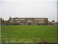
Schools
| Rank | School | Type | Entry gender | Ages |
|---|
Explore more schools in this area
Go to Schools tabDemographics
Household Size
Two person
most common
Accommodation Type
Houses
most common
Tenure
84
majority
Ethnic Group
White
most common
Religion
N/A
most common
Household Composition
N/A
most common
Age
47
median
Adults (30-64 years)
most common
Household Deprivation
N/A
with no deprivation
NS-SEC
56
in Lower managerial occupations
Explore more demographic insights in this area
Go to Demographics tabPlanning
Planning Constraints
- Flood RiskPremium
- Ramsar Wetland SitesPremium
- Area of Outstanding Natural BeautyPremium
- Protected Nature ReservePremium
- Protected WoodlandPremium