Area Overview for B91 3EL
Photos of B91 3EL
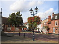
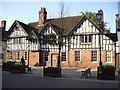
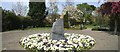
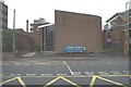
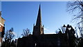
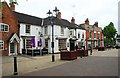
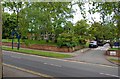
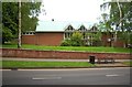
100 photos from this area
Area Information
Key information about the B91 3EL including its size, population, and administrative classification.
- Area Type
- Postcode
- Area Size
- 8643 m²
- Population
- 1660
- Population Density
- 1539 people/km²
House Prices in B91 3EL
7
Properties
£751,786
Average Sold Price
£376,500
Lowest Price
£1,425,000
Highest Price
Showing 7 properties
| Address | Type | Beds | Baths | Last Sale Price | Last Sale Date | |
|---|---|---|---|---|---|---|
| 800 Warwick Road, St Alphege, Solihull, B91 3EL | house | 5 | 4 | £1,425,000 | Jul 2024 | |
| 796 Warwick Road, St Alphege, Solihull, B91 3EL | Detached | 4 | 2 | £1,050,000 | Oct 2021 | |
| 788 Warwick Road, St Alphege, Solihull, B91 3EL | Detached | 5 | 5 | £542,000 | Jan 2014 | |
| 792 Warwick Road, St Alphege, Solihull, B91 3EL | house | 5 | - | £625,000 | Mar 2011 | |
| 790 Warwick Road, St Alphege, Solihull, B91 3EL | house | - | - | £560,000 | Jul 2010 | |
| 798 Warwick Road, St Alphege, Solihull, B91 3EL | Detached | 5 | - | £684,000 | Sep 2003 | |
| 794 Warwick Road, St Alphege, Solihull, B91 3EL | Detached | - | - | £376,500 | May 2001 |
Energy Efficiency in B91 3EL
Amenities
Schools
| Rank | School | Type | Entry gender | Ages |
|---|
Explore more schools in this area
Go to Schools tabDemographics
Household Size
One person
most common
Accommodation Type
Houses
most common
Tenure
76
majority
Ethnic Group
White
most common
Religion
N/A
most common
Household Composition
N/A
most common
Age
47
median
Adults (30-64 years)
most common
Household Deprivation
N/A
with no deprivation
NS-SEC
56
in Lower managerial occupations
Explore more demographic insights in this area
Go to Demographics tabPlanning
Planning Constraints
- Flood RiskPremium
- Ramsar Wetland SitesPremium
- Area of Outstanding Natural BeautyPremium
- Protected Nature ReservePremium
- Protected WoodlandPremium