Area Overview for B91 2NP
Photos of B91 2NP
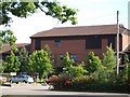
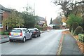
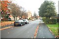
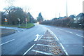
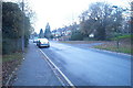
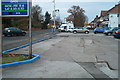
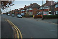
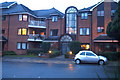
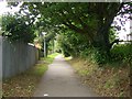
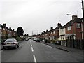
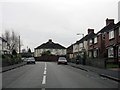
100 photos from this area
Area Information
Key information about the B91 2NP including its size, population, and administrative classification.
- Area Type
- Postcode
- Area Size
- 7319 m²
- Population
- 1740
- Population Density
- 2235 people/km²
House Prices in B91 2NP
29
Properties
£237,963
Average Sold Price
£120,000
Lowest Price
£415,000
Highest Price
Showing 29 properties
| Address | Type | Beds | Baths | Last Sale Price | Last Sale Date | |
|---|---|---|---|---|---|---|
| 7 Broomfields Avenue, Solihull, B91 2NP | Maisonette | 2 | 1 | £190,000 | Jul 2025 | |
| 9 Broomfields Avenue, Solihull, B91 2NP | Terraced | 3 | 1 | £415,000 | Dec 2024 | |
| 21 Broomfields Avenue, Solihull, B91 2NP | house | 2 | 1 | £385,000 | Sep 2022 | |
| 15 Broomfields Avenue, Solihull, B91 2NP | Terraced | 2 | 2 | £328,500 | Oct 2020 | |
| 35 Broomfields Avenue, Solihull, B91 2NP | house | - | - | £275,000 | Aug 2019 | |
| 33 Broomfields Avenue, Solihull, B91 2NP | Terraced | 2 | 1 | £300,000 | Feb 2019 | |
| 29 Broomfields Avenue, Solihull, B91 2NP | Terraced | 2 | 1 | £278,000 | Sep 2017 | |
| 37 Broomfields Avenue, Solihull, B91 2NP | house | - | - | £274,950 | Jul 2016 | |
| 3 Broomfields Avenue, Solihull, B91 2NP | Flat | - | - | £132,500 | Jun 2015 | |
| 1 Broomfields Avenue, Solihull, B91 2NP | Maisonette | - | - | £128,000 | May 2015 |
Page 1 of 3
Energy Efficiency in B91 2NP
Amenities
Schools
| Rank | School | Type | Entry gender | Ages |
|---|
Explore more schools in this area
Go to Schools tabDemographics
Household Size
One person
most common
Accommodation Type
Flats
most common
Tenure
65
majority
Ethnic Group
White
most common
Religion
N/A
most common
Household Composition
N/A
most common
Age
47
median
Elderly (65+ years)
most common
Household Deprivation
N/A
with no deprivation
NS-SEC
47
in Lower managerial occupations
Explore more demographic insights in this area
Go to Demographics tabPlanning
Planning Constraints
- Flood RiskPremium
- Ramsar Wetland SitesPremium
- Area of Outstanding Natural BeautyPremium
- Protected Nature ReservePremium
- Protected WoodlandPremium