Area Overview for B91 2EX
Photos of B91 2EX


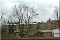


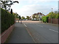


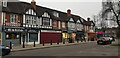

35 photos from this area
Area Information
Key information about the B91 2EX including its size, population, and administrative classification.
- Area Type
- Postcode
- Area Size
- 6042 m²
- Population
- 1599
- Population Density
- 1836 people/km²
House Prices in B91 2EX
9
Properties
£380,286
Average Sold Price
£200,000
Lowest Price
£655,000
Highest Price
Showing 9 properties
| Address | Type | Beds | Baths | Last Sale Price | Last Sale Date | |
|---|---|---|---|---|---|---|
| 18 Dove House Lane, Solihull, B91 2EX | Semi-detached | 4 | 1 | £655,000 | Dec 2024 | |
| 24 Dove House Lane, Solihull, B91 2EX | Semi-detached | 4 | - | £405,000 | Nov 2014 | |
| 20 Dove House Lane, Solihull, B91 2EX | Semi-detached | 5 | - | £420,000 | Jun 2013 | |
| 30 Dove House Lane, Solihull, B91 2EX | Semi-detached | 4 | - | £340,000 | Sep 2012 | |
| 26 Dove House Lane, Solihull, B91 2EX | house | - | - | £315,000 | Nov 2010 | |
| 32 Dove House Lane, Solihull, B91 2EX | Detached | - | - | £327,000 | Jul 2002 | |
| 22 Dove House Lane, Solihull, B91 2EX | Semi-detached | - | - | £200,000 | Jun 2001 | |
| 16 Dove House Lane, Solihull, B91 2EX | Semi-detached | - | - | - | - | |
| 28 Dove House Lane, Solihull, B91 2EX | Semi-detached | - | - | - | - |
Energy Efficiency in B91 2EX
Amenities
Schools
| Rank | School | Type | Entry gender | Ages |
|---|
Explore more schools in this area
Go to Schools tabDemographics
Household Size
Family (3-5 people)
most common
Accommodation Type
Houses
most common
Tenure
93
majority
Ethnic Group
White
most common
Religion
N/A
most common
Household Composition
N/A
most common
Age
47
median
Adults (30-64 years)
most common
Household Deprivation
N/A
with no deprivation
NS-SEC
49
in Lower managerial occupations
Explore more demographic insights in this area
Go to Demographics tabPlanning
Planning Constraints
- Flood RiskPremium
- Ramsar Wetland SitesPremium
- Area of Outstanding Natural BeautyPremium
- Protected Nature ReservePremium
- Protected WoodlandPremium