Area Overview for B91 2DB
Photos of B91 2DB
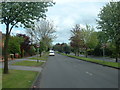
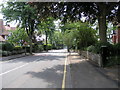
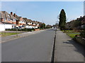
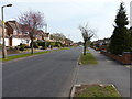
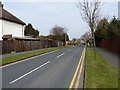
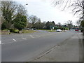
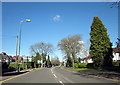
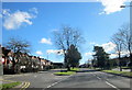
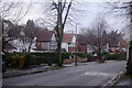
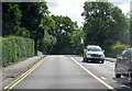
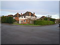
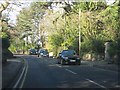
20 photos from this area
Area Information
Key information about the B91 2DB including its size, population, and administrative classification.
- Area Type
- Postcode
- Area Size
- 2.2 hectares
- Population
- 1671
- Population Density
- 2847 people/km²
House Prices in B91 2DB
33
Properties
£413,588
Average Sold Price
£100,000
Lowest Price
£650,000
Highest Price
Showing 33 properties
| Address | Type | Beds | Baths | Last Sale Price | Last Sale Date | |
|---|---|---|---|---|---|---|
| 41 St Helens Road, Solihull, B91 2DB | house | - | - | £570,000 | Oct 2024 | |
| 63 St Helens Road, Solihull, B91 2DB | Semi-detached | 3 | 1 | £540,000 | Jul 2023 | |
| 49 St Helens Road, Solihull, B91 2DB | house | - | - | £495,000 | Aug 2021 | |
| 29 St Helens Road, Solihull, B91 2DB | house | - | - | £532,500 | Jun 2021 | |
| 47 St Helens Road, Solihull, B91 2DB | Semi-detached | 4 | 4 | £630,000 | Aug 2020 | |
| 27 St Helens Road, Solihull, B91 2DB | Detached | 3 | 1 | £505,000 | Feb 2020 | |
| 37 St Helens Road, Solihull, B91 2DB | house | - | - | £495,000 | Jan 2019 | |
| 57 St Helens Road, Solihull, B91 2DB | Detached | 4 | 2 | £650,000 | Dec 2018 | |
| 43 St Helens Road, Solihull, B91 2DB | Semi-detached | 3 | 1 | £462,000 | Aug 2017 | |
| 65 St Helens Road, Solihull, B91 2DB | Detached | 5 | 1 | £565,000 | Mar 2017 |
Page 1 of 4
Energy Efficiency in B91 2DB
Amenities
Schools
| Rank | School | Type | Entry gender | Ages |
|---|
Explore more schools in this area
Go to Schools tabDemographics
Household Size
Family (3-5 people)
most common
Accommodation Type
Houses
most common
Tenure
92
majority
Ethnic Group
White
most common
Religion
N/A
most common
Household Composition
N/A
most common
Age
47
median
Adults (30-64 years)
most common
Household Deprivation
N/A
with no deprivation
NS-SEC
55
in Lower managerial occupations
Explore more demographic insights in this area
Go to Demographics tabPlanning
Planning Constraints
- Flood RiskPremium
- Ramsar Wetland SitesPremium
- Area of Outstanding Natural BeautyPremium
- Protected Nature ReservePremium
- Protected WoodlandPremium