Area Overview for B91 2BB
Photos of B91 2BB
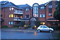
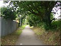
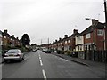
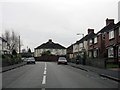
100 photos from this area
Area Information
Key information about the B91 2BB including its size, population, and administrative classification.
- Area Type
- Postcode
- Area Size
- 1.8 hectares
- Population
- 1671
- Population Density
- 2847 people/km²
House Prices in B91 2BB
32
Properties
£398,683
Average Sold Price
£140,000
Lowest Price
£600,000
Highest Price
Showing 32 properties
| Address | Type | Beds | Baths | Last Sale Price | Last Sale Date | |
|---|---|---|---|---|---|---|
| 207 Buryfield Road, Solihull, B91 2BB | house | 3 | 1 | £480,000 | Jan 2025 | |
| 171 Buryfield Road, Solihull, B91 2BB | Detached | 4 | 2 | £600,000 | May 2022 | |
| 177 Buryfield Road, Solihull, B91 2BB | Detached | 4 | 1 | £502,500 | Nov 2019 | |
| 181 Buryfield Road, Solihull, B91 2BB | Detached | 3 | 1 | £456,850 | Jul 2019 | |
| 153 Buryfield Road, Solihull, B91 2BB | Detached | 4 | 1 | £475,000 | Jun 2019 | |
| 185 Buryfield Road, Solihull, B91 2BB | Detached | 4 | 2 | £515,000 | Mar 2018 | |
| 169 Buryfield Road, Solihull, B91 2BB | Detached | 4 | 1 | £550,000 | Feb 2018 | |
| 151 Buryfield Road, Solihull, B91 2BB | Detached | 4 | 1 | £455,000 | Feb 2018 | |
| 201 Buryfield Road, Solihull, B91 2BB | Detached | 3 | 1 | £380,000 | Oct 2016 | |
| 159 Buryfield Road, Solihull, B91 2BB | Detached | 4 | 2 | £432,000 | Jun 2015 |
Page 1 of 4
Energy Efficiency in B91 2BB
Amenities
Schools
| Rank | School | Type | Entry gender | Ages |
|---|
Explore more schools in this area
Go to Schools tabDemographics
Household Size
Family (3-5 people)
most common
Accommodation Type
Houses
most common
Tenure
92
majority
Ethnic Group
White
most common
Religion
N/A
most common
Household Composition
N/A
most common
Age
47
median
Adults (30-64 years)
most common
Household Deprivation
N/A
with no deprivation
NS-SEC
55
in Lower managerial occupations
Explore more demographic insights in this area
Go to Demographics tabPlanning
Planning Constraints
- Flood RiskPremium
- Ramsar Wetland SitesPremium
- Area of Outstanding Natural BeautyPremium
- Protected Nature ReservePremium
- Protected WoodlandPremium