Area Overview for B91 1NX
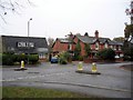
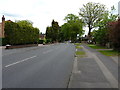
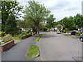
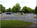
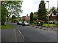
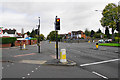
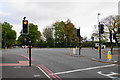
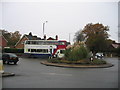
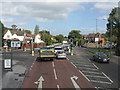
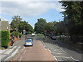
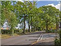
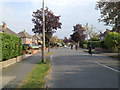
Photos of B91 1NX
Area Information
Living in B91 1NX places you at the heart of the historic electoral ward of St Alphege within the Metropolitan Borough of Solihull. This specific postcode covers a small residential cluster spanning just 1.5 hectares, hosting a population of 1798 people. The area forms part of the historic core of Solihull town, a planned medieval settlement founded by the de Limsey family between 1170 and 1180. St Alphege Church, a Grade I listed building with a prominent spire, stands at the head of High Street, marking the town's formation as a trade hub since the mid-12th century. Daily life revolves close to these significant landmarks and the weekly market traditions established over eight centuries ago. The neighbourhood functions as a compact community where residents benefit from tight proximity to major urban centres without being swallowed by them. You live in an environment defined by deep historical roots, having witnessed the church's expansion under Sir William de Odingsells and the reconstruction phases that shape its current medieval Gothic appearance. The area is situated near coordinates 52.416641, -1.801421, anchoring it firmly in Solihull's geography. Your daily routine involves walking steps from the historic centre to access both modern retail facilities and traditional village life. The density ensures a walkable environment while maintaining a connection to the wider West Midlands region.
- Area Type
- Postcode
- Area Size
- 1.5 hectares
- Population
- 1798
- Population Density
- 1383 people/km²
The property market in B91 1NX is characterised by a strong leaning towards ownership rather than rental living. Sixty-six per cent of households own their properties, creating a district where residents are invested in the long-term maintenance and value of their homes. This ownership percentage significantly outpaces the rental sector, suggesting that B91 1NX attracts buyers who plan to stay for decades rather than short-term tenants. Flats constitute the primary accommodation type available in this specific postcode area. This housing stock of flats aligns with the area's compact nature, covering only 1.5 hectares while supporting 1798 residents. Smaller units allow for efficient living in a high-density environment where the population reaches 1383 people per square kilometre. For prospective buyers, entering this market means joining an established community where families and individuals have put down roots over many years. The concentration of flats means you should expect vertical living arrangements that maximise the available land. This layout is typical of urban cores where space is at a premium but demand for quality interiors remains high.
House Prices in B91 1NX
Showing 9 properties
| Address | Type | Beds | Baths | Last Sale Price | Last Sale Date | |
|---|---|---|---|---|---|---|
| 7 Endwood Drive, Solihull, B91 1NX | house | - | - | £700,000 | Jan 2020 | |
| 3 Endwood Drive, Solihull, B91 1NX | Bungalow | 3 | - | £510,000 | Jan 2015 | |
| 1 Endwood Drive, Solihull, B91 1NX | Detached | 5 | 3 | £814,000 | Feb 2014 | |
| 5 Endwood Drive, Solihull, B91 1NX | Bungalow | 3 | 2 | £455,000 | Aug 2013 | |
| 4 Endwood Drive, Solihull, B91 1NX | Bungalow | 3 | - | £420,000 | Nov 2010 | |
| 6 Endwood Drive, Solihull, B91 1NX | Detached | - | - | £250,000 | Oct 2000 | |
| 2 Endwood Drive, Solihull, B91 1NX | Detached | 4 | 2 | - | - | |
| 8 Endwood Drive, Solihull, B91 1NX | Detached | - | - | - | - | |
| 9 Endwood Drive, Solihull, B91 1NX | Detached | - | - | - | - |
Energy Efficiency in B91 1NX
Residents of B91 1NX enjoy excellent access to essential amenities within the St Alphege ward and surrounding Solihull town. Retail options include Co-op Shirley, Waitrose Solihull, and Aldi Homer, providing daily necessities across multiple chains. There are five notable retail venues in your immediate vicinity, ensuring you find whatever groceries or household items you need nearby. Transport links五条 include Solihull Railway Station, Widney Manor Railway Station, and Shirley Railway Station, offering convenient rail connections beyond the immediate neighbourhood. The area connects to major regional airports and hubs, with Birmingham International Airport and Birmingham Intl Railway Station located nearby. This proximity to two metro-level transport nodes means you can travel to national destinations quickly and easily. Your lifestyle balances the convenience of modern shopping with the quietude of living in a medieval settlement founded by the de Limsey family. You walk to five local transport points while staying close to family-friendly shops that cater to residents of all ages. The retail and transport density ensures no significant errand requires a lengthy drive, keeping daily logistics simple and efficient.
Amenities
Schools
Families in B91 1NX have access to a diverse range of educational institutions known as nearby schools. Educational choices include St Augustine's Catholic Primary School, St Peter's Catholic School, Malvern Hall School, and Solihull College & University Centre. The latter serves as a sixth-form institution, providing secondary education options for older students finishing their compulsory schooling. These schools offer both primary and post-primary education within practical reach of the residential cluster. You can choose from Catholic primary schools that maintain religious educational frameworks or general education providers like Malvern Hall School. The presence of Solihull College & University Centre indicates that higher education or further vocational training is also accessible to residents without needing to travel major distances. This mix ensures that children from age five through to sixteenth birthday can find suitable local provisions. Blossomfield Centre completes the list of nearby educational facilities, offering alternative environments for learning and development. The variety allows parents to select institutions that match their specific educational philosophies and academic requirements for their children.
| Rank | School | Type | Entry gender | Ages |
|---|
Explore more schools in this area
Go to Schools tabDemographics
The community in B91 1NX reflects an established neighbourhood with a median age of 47 years. More than half of the residents fall into the adult age range of 30 to 64 years, indicating a population driven by working-age families and individuals rather than young children or retirees. This age profile suggests a stable community where life stages are represented by those already settled in the area. You will find a high level of resident commitment to the location, as 66 per cent of households own their homes outright or with a mortgage. This ownership rate of two-thirds creates a settled demographic with long-term ties to B91 1NX. Transport and family structures appear to prioritise flats as the predominant accommodation type within this cluster. This layout suits the high density figure of 1383 people per square kilometre, maximising efficient use of the limited 1.5-hectare space. The area serves predominantly White residents according to the breakdown of predominant ethnic groups. While specific minority data is not detailed in the provided figures, the dominance of one group signals a culturally familiar environment for the majority. Your daily interactions are likely shaped by this maturity and stability, with neighbours who have lived through the ward's modern iteration and maintain connections to the historic past.
Household Size
Accommodation Type
Tenure
Ethnic Group
Religion
Household Composition
Age
Household Deprivation
NS-SEC
Explore more demographic insights in this area
Go to Demographics tabPlanning
Planning Constraints
- Flood RiskPremium
- Ramsar Wetland SitesPremium
- Area of Outstanding Natural BeautyPremium
- Protected Nature ReservePremium
- Protected WoodlandPremium