Area Overview for B91 1NW
Photos of B91 1NW
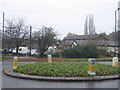
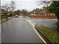
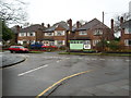
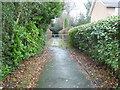
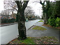
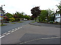
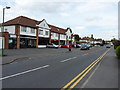
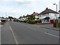
31 photos from this area
Area Information
Key information about the B91 1NW including its size, population, and administrative classification.
- Area Type
- Postcode
- Area Size
- 2.9 hectares
- Population
- 1687
- Population Density
- 2733 people/km²
House Prices in B91 1NW
21
Properties
£1,166,875
Average Sold Price
£275,000
Lowest Price
£3,100,000
Highest Price
Showing 21 properties
| Address | Type | Beds | Baths | Last Sale Price | Last Sale Date | |
|---|---|---|---|---|---|---|
| 52 Alderbrook Road, Solihull, B91 1NW | Detached | 5 | 4 | £1,560,000 | May 2024 | |
| 50 Alderbrook Road, Solihull, B91 1NW | Detached | 5 | 3 | £1,600,000 | Dec 2023 | |
| 44 Alderbrook Road, Solihull, B91 1NW | house | - | - | £1,400,000 | Nov 2022 | |
| 58 Alderbrook Road, Solihull, B91 1NW | Detached | 6 | 6 | £3,100,000 | Aug 2022 | |
| 42 Alderbrook Road, Solihull, B91 1NW | house | - | - | £1,135,000 | Aug 2022 | |
| 37 Alderbrook Road, Solihull, B91 1NW | house | 5 | 5 | £1,900,000 | Jul 2022 | |
| 29 Alderbrook Road, Solihull, B91 1NW | house | - | - | £1,350,000 | Mar 2015 | |
| 40 Alderbrook Road, Solihull, B91 1NW | Detached | 6 | 6 | £1,450,000 | Oct 2014 | |
| 46 Alderbrook Road, Solihull, B91 1NW | house | - | - | £860,000 | Sep 2011 | |
| 31 Alderbrook Road, Solihull, B91 1NW | Detached | - | - | £700,000 | May 2007 |
Page 1 of 3
Energy Efficiency in B91 1NW
Amenities
Schools
| Rank | School | Type | Entry gender | Ages |
|---|
Explore more schools in this area
Go to Schools tabDemographics
Household Size
Family (3-5 people)
most common
Accommodation Type
Houses
most common
Tenure
95
majority
Ethnic Group
White
most common
Religion
N/A
most common
Household Composition
N/A
most common
Age
47
median
Adults (30-64 years)
most common
Household Deprivation
N/A
with no deprivation
NS-SEC
58
in Lower managerial occupations
Explore more demographic insights in this area
Go to Demographics tabPlanning
Planning Constraints
- Flood RiskPremium
- Ramsar Wetland SitesPremium
- Area of Outstanding Natural BeautyPremium
- Protected Nature ReservePremium
- Protected WoodlandPremium