Area Overview for B91 1HE
Photos of B91 1HE
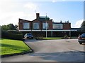
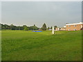
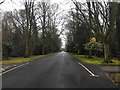
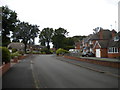
16 photos from this area
Area Information
Key information about the B91 1HE including its size, population, and administrative classification.
- Area Type
- Postcode
- Area Size
- 1.4 hectares
- Population
- 1405
- Population Density
- 1494 people/km²
House Prices in B91 1HE
21
Properties
£436,086
Average Sold Price
£154,000
Lowest Price
£815,000
Highest Price
Showing 21 properties
| Address | Type | Beds | Baths | Last Sale Price | Last Sale Date | |
|---|---|---|---|---|---|---|
| 249 Streetsbrook Road, Solihull, B91 1HE | Detached | 5 | 3 | £815,000 | Oct 2024 | |
| 221 Streetsbrook Road, Solihull, B91 1HE | house | - | - | £585,000 | Feb 2020 | |
| 243 Streetsbrook Road, Solihull, B91 1HE | Detached | 5 | 2 | £635,000 | Mar 2018 | |
| 257 Streetsbrook Road, Solihull, B91 1HE | Detached | 4 | 1 | £472,000 | Aug 2016 | |
| 241 Streetsbrook Road, Solihull, B91 1HE | Detached | 4 | - | £528,000 | Aug 2014 | |
| 233 Streetsbrook Road, Solihull, B91 1HE | Detached | 5 | 3 | £465,000 | Jul 2014 | |
| 251 Streetsbrook Road, Solihull, B91 1HE | Detached | - | - | £325,000 | Dec 2008 | |
| 235 Streetsbrook Road, Solihull, B91 1HE | Detached | - | - | £330,000 | Aug 2003 | |
| 225 Streetsbrook Road, Solihull, B91 1HE | Detached | - | - | £329,950 | Dec 2002 | |
| 247 Streetsbrook Road, Solihull, B91 1HE | house | - | - | £154,000 | Jul 1998 |
Page 1 of 3
Energy Efficiency in B91 1HE
Amenities
Schools
| Rank | School | Type | Entry gender | Ages |
|---|
Explore more schools in this area
Go to Schools tabDemographics
Household Size
Family (3-5 people)
most common
Accommodation Type
Houses
most common
Tenure
94
majority
Ethnic Group
White
most common
Religion
N/A
most common
Household Composition
N/A
most common
Age
47
median
Adults (30-64 years)
most common
Household Deprivation
N/A
with no deprivation
NS-SEC
51
in Lower managerial occupations
Explore more demographic insights in this area
Go to Demographics tabPlanning
Planning Constraints
- Flood RiskPremium
- Ramsar Wetland SitesPremium
- Area of Outstanding Natural BeautyPremium
- Protected Nature ReservePremium
- Protected WoodlandPremium