Area Overview for B91 1DR
Photos of B91 1DR

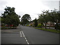
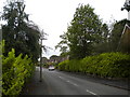
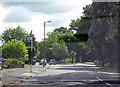
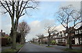

23 photos from this area
Area Information
Key information about the B91 1DR including its size, population, and administrative classification.
- Area Type
- Postcode
- Area Size
- 9753 m²
- Population
- 1405
- Population Density
- 1494 people/km²
House Prices in B91 1DR
22
Properties
£403,830
Average Sold Price
£135,000
Lowest Price
£722,500
Highest Price
Showing 22 properties
| Address | Type | Beds | Baths | Last Sale Price | Last Sale Date | |
|---|---|---|---|---|---|---|
| 31 Wroxall Road, Solihull, B91 1DR | Detached | 4 | 3 | £642,500 | Dec 2024 | |
| 17 Wroxall Road, Solihull, B91 1DR | house | - | - | £415,000 | Feb 2024 | |
| 25 Wroxall Road, Solihull, B91 1DR | Detached | 3 | 1 | £722,500 | May 2023 | |
| 11 Wroxall Road, Solihull, B91 1DR | house | - | - | £490,000 | Oct 2021 | |
| 37 Wroxall Road, Solihull, B91 1DR | house | 3 | 1 | £435,000 | Apr 2019 | |
| 47 Wroxall Road, Solihull, B91 1DR | Semi-detached | 4 | 2 | £430,000 | Jul 2018 | |
| 19 Wroxall Road, Solihull, B91 1DR | Semi-detached | 3 | 1 | £385,000 | Oct 2017 | |
| 27 Wroxall Road, Solihull, B91 1DR | Detached | 5 | 2 | £470,000 | Mar 2016 | |
| 35 Wroxall Road, Solihull, B91 1DR | house | 3 | - | £295,000 | Sep 2013 | |
| 33 Wroxall Road, Solihull, B91 1DR | house | - | - | £388,000 | May 2013 |
Page 1 of 3
Energy Efficiency in B91 1DR
Amenities
Schools
| Rank | School | Type | Entry gender | Ages |
|---|
Explore more schools in this area
Go to Schools tabDemographics
Household Size
Family (3-5 people)
most common
Accommodation Type
Houses
most common
Tenure
94
majority
Ethnic Group
White
most common
Religion
N/A
most common
Household Composition
N/A
most common
Age
47
median
Adults (30-64 years)
most common
Household Deprivation
N/A
with no deprivation
NS-SEC
51
in Lower managerial occupations
Explore more demographic insights in this area
Go to Demographics tabPlanning
Planning Constraints
- Flood RiskPremium
- Ramsar Wetland SitesPremium
- Area of Outstanding Natural BeautyPremium
- Protected Nature ReservePremium
- Protected WoodlandPremium