Area Overview for B91 1AH
Photos of B91 1AH


Area Information
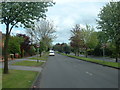
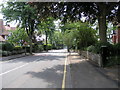
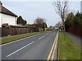
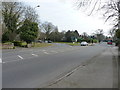
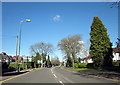
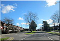
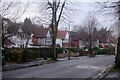
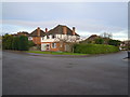
Living in B91 1AH within Silhill Ward offers a rare combination of low density and high convenience for those who prefer a neighbourhood feel without isolation. This specific postcode covers a tiny residential cluster of just 2538 square metres, yet it houses a distinct population of 1671 people. The area is situated in the Metropolitan Borough of Solihull, near the historic intersection of Streetsbrook Road and Broad Oaks Road. While the present-day area contains no remnants of the former Silhill Hall, which was demolished in 1966, the location carries a quiet historical weight associated with the Middlemore and Gough families who once owned the land. Residents here enjoy a daily life defined by proximity to key transport hubs, as five railway stations sit within practical reach, including Solihull and Olton stations. The immediate environment is largely characterised by houses rather than high-density blocks, creating a specific atmosphere distinct from the broader commercial sprawl of Solihull. Buying a home in this small sector of B91 provides access to a tightly defined community where the past meets modern connectivity.
- Area Type
- Postcode
- Area Size
- 2538 m²
- Population
- 1671
- Population Density
- 2847 people/km²
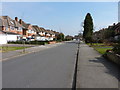
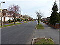
The property market in B91 1AH is overwhelmingly dominated by house ownership, a fact confirmed by the fact that 92% of homes are owner-occupied. This statistic paints a clear picture of the housing stock: it is primarily composed of houses rather than rental apartments or purpose-built blocks of flats. For a prospective buyer, this consistency means the local real estate landscape is stable and likely reflects long-term investment intentions rather than short-term letting arrangements. Because the accommodation type is strictly houses, investors seeking flats or converting properties may find limited options specifically within this small cluster. The high ownership percentage also implies that sellers in this area often have fewer tenants, which can streamline the buying process and reduce periods of vacancy. When looking at the immediate surroundings of this 2538 square metre area, the market continues this trend, offering a reliable supply of family homes. Buyers should expect a market where property values are underpinned by the desirability of owning a standalone house in a settled community. The lack of diverse housing types suggests a consistent property profile, meaning one should not expect sudden variations in building style or tenure across the B91 postcode group.
House Prices in B91 1AH
Showing 10 properties
Energy Efficiency in B91 1AH
Daily life in B91 1AH is supported by a wide array of amenities that are all within practical reach of your doorstep. You can shop at five nearby retail locations, including Tesco Lode, Tesco Solihull, and Waitrose Solihull, ensuring you have full grocery and household supplies without needing to travel far. For rail travel, five stations serve the area, with Solihull, Olton, and Widney Manor being the notable stops for local journey requirements. If your needs extend to air travel or long-distance rail connections, two major hubs are nearby, specifically Birmingham International Airport and Birmingham International Railway Station. This concentration of transport and retail creates a lifestyle where convenience does not rely on hours of commuting to the city centre. The presence of Waitrose and multiple Tesco locations suggests a shopping environment that combines everyday affordability with premium quality options. Residents can manage weekly shopping, pick up fresh produce, or grab essentials locally, all while knowing that major transport arteries are minutes away. This accessibility defines the character of the neighbourhood, making the small residential cluster of 2538 square metres function as a well-connected hub rather than a remote pocket.
Amenities
Schools
Families considering living in B91 1AH have access to a range of educational institutions nearby, providing flexibility for different schooling preferences. The area is served by Lode Heath School, which operates as a primary institution and also functions as an academy with a good Ofsted rating. This dual designation indicates a state school that meets balanced standards while enjoying specific autonomy. For families seeking independent education, Eversfield Preparatory School is located near the area, offering an alternative route outside the state system. The mix of state academy status and independent provision allows parents to choose based on curriculum or teaching philosophy without travelling far. Having two schools open for day pupils and one as an academy ensures that educational options are varied yet geographically close. These institutions are listed as the nearest schools to the B91 1AH postcode, meaning you do not need to leave the immediate Silhill Ward environment to secure high-quality education for your children. The presence of an independent preparatory school often attracts families who plan for long-term educational trajectories, further reinforcing the established demographic profile of the neighbourhood.
| Rank | School | Type | Entry gender | Ages |
|---|
Explore more schools in this area
Go to Schools tabDemographics
The community residing in B91 1AH presents a stable, mature profile with a median age of 47 years. The most common age range for residents falls between 30 and 64 years, indicating that the area attracts working families and established professionals rather than students or retirees. Homeownership rates are exceptionally high at 92%, suggesting that the vast majority of local households live in their own properties rather than renting. This ownership stability typically correlates with long-term residents who are invested in the local fabric of the ward. The predominant ethnic group is White, reflecting the established nature of the housing stock in this part of Solihull. Accommodation types are almost exclusively houses, meaning you will find detached and semi-detached properties rather than flats or terraced rows. With a population density that appears counterintuitively high when calculated against the tiny 2538 square metre size, this specific postcode represents a very concentrated pocket of residential life. The demographic makeup suggests a neighbourhood where residents are likely to know one another, given the high proportion of owner-occupiers in a small geographical footprint.
Household Size
Accommodation Type
Tenure
Ethnic Group
Religion
Household Composition
Age
Household Deprivation
NS-SEC
Explore more demographic insights in this area
Go to Demographics tabPlanning
Planning Constraints
- Flood RiskPremium
- Ramsar Wetland SitesPremium
- Area of Outstanding Natural BeautyPremium
- Protected Nature ReservePremium
- Protected WoodlandPremium