Area Overview for B90 4ZJ
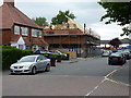
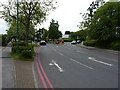
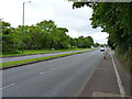
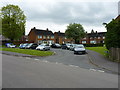
Photos of B90 4ZJ

Area Information
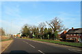
The postcode area B90 4ZJ sits within Shirley South, an electoral ward in the Metropolitan Borough of Solihull. This residential cluster forms part of a larger district that historically evolved from an Iron Age settlement into a prominent suburb. Currently, the population stands at 1,574 residents. The location is bisected by Stratford Road, a historic arterial route that has shaped the area's development for centuries. Living in B90 4ZJ means being situated in a region that blends urban residential density with significant commercial activity. The area operates as a hub for workplace jobs, hosting office businesses and distribution hubs alongside traditional retail spaces. Prosperity varies across the wider ward, with eastern zones like Monkspath and Blossomfield showing higher levels of economic activity. While specific boundaries for the B90 4ZJ postcode cover only a small cluster, it offers immediate access to the broader Solihull network. The location benefits from being close to major transport links and employment centres, making it a practical choice for commuters working in the wider metropolitan area.
- Area Type
- Postcode
- Area Size
- Not available
- Population
- 1574
- Population Density
- 4672 people/km²
The housing market in B90 4ZJ is dominated by owner-occupied homes. With a 91% home ownership rate, the area functions primarily as a settled residential zone rather than a private rental market. Houses constitute the standard accommodation type for residents in this postcode. This high level of tenure implies that many properties were built long ago or have been occupied by the same families for decades. If you are looking to buy homes in B90 4ZJ, you will likely enter a market of established dwellings. The surrounding Shirley South ward features a mix of housing that developed post-WWII, including significant housing estates. The local economy supports this market through nearby office businesses and distribution hubs, ensuring demand for stable residential properties remains steady. Buyers should expect a neighbourhood where the electorate is largely permanent. The prevalence of houses over apartments aligns with the suburban character of Solihull. This stability makes the area attractive for those seeking to purchase a family home with long-term security.
House Prices in B90 4ZJ
No properties found in this postcode.
Energy Efficiency in B90 4ZJ
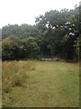
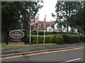
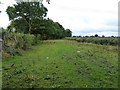
Daily life in B90 4ZJ is defined by close access to essential amenities and retail options. Five retail locations operate within easy reach, including Sainsburys Marshall, Lidl Sears, and M&S Sears. These supermarkets form the backbone of local shopping needs. The area also benefits from five railway stations in the immediate vicinity, facilitating easy commutes. Notably, the nearby stations include Shirley Railway Station, Whitlocks End Railway Station, and Solihull Railway Station. For international travel, Birmingham International Airport and Birmingham Intl Railway Station are just two stations away. The character of the wider Shirley area includes historic landmarks such as St James' Church and the historic Shirley Street. Recreation options extend to Marshall Lake park, a notable green space often associated with the district. The economic drive of the area includes private and public sector offices as well as large retail facilities at Marshall Lake park. This mix provides convenience for daily errands while maintaining a suburban rhythm. Living in B90 4ZJ means having all essential services within a short drive or walk from your home.
Amenities
Schools
Families living in B90 4ZJ rely on specific educational institutions for their children's schooling. The closest school to the area is Our Lady of the Wayside Catholic Primary School. This institution serves as a primary education provider for young residents in the ward. The data currently lists this single entry for primary education within the immediate vicinity of B90 4ZJ. There are no secondary schools explicitly named in the provided details for this specific postcode cluster, though Sharmans Cross Senior School is noted as a notable feature of the broader Shirley area history. For parents seeking schools near B90 4ZJ, Our Lady of the Wayside Catholic Primary School is the clear local option. The presence of a Catholic primary school indicates a community with established religious groups. While secondary options are not detailed for this specific postcode in the current information, the proximity to Solihull generally ensures access to a range of high schools further into the borough. Local education provision appears focused on early years within the immediate cluster.
| Rank | School | Type | Entry gender | Ages |
|---|
Explore more schools in this area
Go to Schools tabDemographics
Residents of B90 4ZJ make up a tightly knit community where age and home ownership define daily life. The median age for the population is 47 years. Most households consist of adults aged between 30 and 64 years. This demographic profile suggests a settled workforce rather than a transient student population. Home ownership is exceptionally high within this cluster, reaching 91%. Consequently, the vast majority of residents live in houses. The predominant ethnic group is White, reflecting a long-established community structure. The high rate of ownership indicates that properties here have likely been passed down or purchased by families who intend to remain for the long term. Deprivation is notably low, as evidenced by the high safety score and strong housing tenure statistics. This demographic stability creates a quiet neighbourhood where local families have deep roots in Shirley South. The age profile aligns with a community minimised of young single households and maximised towards established family units or retirees residing in their own homes.
Household Size
Accommodation Type
Tenure
Ethnic Group
Religion
Household Composition
Age
Household Deprivation
NS-SEC
Explore more demographic insights in this area
Go to Demographics tabPlanning
Planning Constraints
- Flood RiskPremium
- Ramsar Wetland SitesPremium
- Area of Outstanding Natural BeautyPremium
- Protected Nature ReservePremium
- Protected WoodlandPremium