Area Overview for B90 4WX
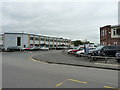
Photos of B90 4WX


Area Information
Living in B90 4WX means inhabiting a small residential cluster in the Shirley area of Solihull, West Midlands. With a population of 1,774, this postcode reflects a suburban setting that evolved from a rural settlement into a modern residential hub. Historically linked to Warwickshire, the area bisected by Stratford Road (A34) has roots in the 12th century, with Shirley’s name meaning “bright clearing.” Today, it balances urban convenience with historical character, including landmarks like St James’ Church (1832) and the former Odeon Cinema site. The area’s proximity to Solihull’s economic activities, including distribution hubs and retail centres, supports a workforce-oriented community. Daily life here combines practicality with access to amenities such as rail links, supermarkets, and parks. While the population is relatively small, the area’s integration into Solihull’s transport network—via nearby railway stations and motorways—makes it a viable choice for commuters. Its compact size means residents are close to both local services and broader regional opportunities, blending residential tranquility with urban connectivity.
- Area Type
- Postcode
- Area Size
- Not available
- Population
- 1774
- Population Density
- 1992 people/km²
The property market in B90 4WX is defined by a 66% home ownership rate and a predominance of houses over flats. This suggests a market skewed towards owner-occupied properties, with limited rental availability. The focus on single-family homes indicates a demand for larger living spaces, likely catering to families or professionals requiring more space. Given the area’s small size, the housing stock is constrained, which may limit buyer choice and drive competition for available properties. The lack of high-rise or multi-unit developments means the market is less suited to younger buyers or those seeking affordable rentals. For prospective buyers, this means prioritising properties that align with the area’s existing character—traditional houses with gardens—while recognising the potential for limited growth in housing supply. The proximity to Solihull’s commercial zones may also influence property values, as the area serves as a residential base for workers in nearby industries.
House Prices in B90 4WX
No properties found in this postcode.
Energy Efficiency in B90 4WX
Residents of B90 4WX have access to a range of amenities within practical reach, including retail outlets such as M&S Sears, Lidl Sears, and Co-op Shirley, which cater to everyday shopping needs. The area’s rail network is well-served by stations like Widney Manor, Shirley, and Solihull, providing links to Birmingham’s central business district and beyond. Nearby, Birmingham International Airport and Birmingham Intl Railway Station offer regional and national connectivity. Leisure options include Marshall Lake park, a green space for recreation, and historical sites like St James’ Church. The area’s character is shaped by its mix of commercial and residential functions, with a focus on practicality over luxury. While the retail and dining options are modest, the proximity to larger urban centres compensates for local limitations. This balance of convenience and accessibility makes daily life in B90 4WX efficient, though residents may need to venture further for more specialised services or entertainment.
Amenities
Schools
| Rank | School | Type | Entry gender | Ages |
|---|
Explore more schools in this area
Go to Schools tabDemographics
The community in B90 4WX is predominantly composed of adults aged 30–64, with a median age of 47. This suggests a stable, mature population, likely with established careers and families. Home ownership rates stand at 66%, indicating a mix of long-term residents and owner-occupied properties, though not overwhelming. The area is characterised by houses rather than flats, reflecting a preference for single-family dwellings. The predominant ethnic group is White, though specific diversity metrics are not quantified in the data. The age profile implies a community focused on family life and long-term residency, with fewer young professionals or retirees compared to other areas. This demographic structure supports local schools, retail, and services tailored to middle-aged households. The absence of detailed deprivation data means quality of life is inferred from the area’s infrastructure and amenities, which appear to meet basic needs. However, the moderate population size and limited housing stock suggest a relatively insular community with limited scope for demographic diversity.
Household Size
Accommodation Type
Tenure
Ethnic Group
Religion
Household Composition
Age
Household Deprivation
NS-SEC
Explore more demographic insights in this area
Go to Demographics tabPlanning
Planning Constraints
- Flood RiskPremium
- Ramsar Wetland SitesPremium
- Area of Outstanding Natural BeautyPremium
- Protected Nature ReservePremium
- Protected WoodlandPremium