Area Overview for B90 4ST
Photos of B90 4ST
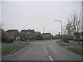

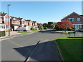


22 photos from this area
Area Information
Key information about the B90 4ST including its size, population, and administrative classification.
- Area Type
- Postcode
- Area Size
- 2.0 hectares
- Population
- 1488
- Population Density
- 2416 people/km²
House Prices in B90 4ST
32
Properties
£405,704
Average Sold Price
£14,592
Lowest Price
£800,000
Highest Price
Showing 32 properties
| Address | Type | Beds | Baths | Last Sale Price | Last Sale Date | |
|---|---|---|---|---|---|---|
| 16 Rowthorn Drive, Monkspath, Solihull, B90 4ST | house | - | - | £470,000 | Dec 2025 | |
| 25 Rowthorn Drive, Monkspath, Solihull, B90 4ST | Detached | 5 | 3 | £800,000 | Sep 2024 | |
| 35 Rowthorn Drive, Monkspath, Solihull, B90 4ST | Detached | 4 | 3 | £505,000 | Apr 2022 | |
| 17 Rowthorn Drive, Monkspath, Solihull, B90 4ST | house | - | - | £525,000 | Mar 2022 | |
| 9 Rowthorn Drive, Monkspath, Solihull, B90 4ST | house | - | - | £580,000 | Feb 2022 | |
| 19 Rowthorn Drive, Monkspath, Solihull, B90 4ST | Detached | 4 | 2 | £485,000 | Jun 2021 | |
| 15 Rowthorn Drive, Monkspath, Solihull, B90 4ST | Detached | 4 | 2 | £480,000 | Aug 2020 | |
| 33 Rowthorn Drive, Monkspath, Solihull, B90 4ST | Detached | 4 | 2 | £472,250 | May 2020 | |
| 29 Rowthorn Drive, Monkspath, Solihull, B90 4ST | Detached | 5 | 3 | £601,000 | Jan 2019 | |
| 3 Rowthorn Drive, Monkspath, Solihull, B90 4ST | Detached | - | - | £14,592 | Aug 2018 |
Page 1 of 4
Energy Efficiency in B90 4ST
Amenities
Schools
| Rank | School | Type | Entry gender | Ages |
|---|
Explore more schools in this area
Go to Schools tabDemographics
Household Size
Family (3-5 people)
most common
Accommodation Type
Houses
most common
Tenure
84
majority
Ethnic Group
White
most common
Religion
N/A
most common
Household Composition
N/A
most common
Age
47
median
Adults (30-64 years)
most common
Household Deprivation
N/A
with no deprivation
NS-SEC
50
in Lower managerial occupations
Explore more demographic insights in this area
Go to Demographics tabPlanning
Planning Constraints
- Flood RiskPremium
- Ramsar Wetland SitesPremium
- Area of Outstanding Natural BeautyPremium
- Protected Nature ReservePremium
- Protected WoodlandPremium