Area Overview for B90 4NL
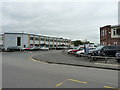
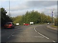
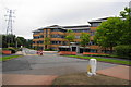
Photos of B90 4NL


Area Information
B90 4NL lies in the Shirley area of Solihull, a historic rural settlement in the West Midlands that evolved into a residential suburb. With a population of 1,774, this small postcode area is characterised by its compact residential cluster, nestled in the urban west of the borough. The area is bisected by Stratford Road (A34), a historic turnpike that once hosted illicit activities like bull-baiting. Today, it connects residents to nearby rail stations, including Widney Manor and Shirley, and to Birmingham International Airport. Shirley’s name, meaning “bright clearing,” reflects its origins as a settlement with roots in an Iron Age hill fort. The area blends urban convenience with a legacy of development from the 1920s, including schools, a lido, and commercial hubs. Living here offers proximity to retail, transport, and employment, with a focus on homes rather than high-density living. The community’s stability is evident in its 66% home ownership rate, suggesting a mix of long-term residents and families seeking a suburban lifestyle.
- Area Type
- Postcode
- Area Size
- Not available
- Population
- 1774
- Population Density
- 1992 people/km²
B90 4NL is primarily an owner-occupied area, with 66% of homes owned by residents rather than rented. The accommodation type is predominantly houses, reflecting a suburban character rather than high-density flats or apartments. This suggests a market focused on family homes and long-term investment, with limited rental availability. The small size of the postcode area means housing stock is concentrated, and buyers should consider the immediate surroundings for additional options. The high home ownership rate indicates a stable market with fewer speculative properties, which may result in steady prices but limited short-term turnover. For buyers, this area appeals to those seeking a settled, low-traffic environment with established infrastructure. However, the compact nature of the postcode may require looking beyond B90 4NL itself for larger property selections. The presence of commercial and distribution hubs nearby also hints at potential for mixed-use development, though this remains speculative.
House Prices in B90 4NL
No properties found in this postcode.
Energy Efficiency in B90 4NL
Residents of B90 4NL have access to a range of amenities within practical reach. Retail options include Co-op Shirley, M&S Sears, and Lidl Sears, offering everyday shopping convenience. The area’s rail network includes Widney Manor, Solihull, and Shirley stations, providing direct links to Birmingham’s transport hubs. Nearby, Birmingham International Airport is a major draw for travel and employment opportunities. The character of the area blends residential and commercial elements, with historic Shirley Street serving as a focal point. While specific parks or leisure facilities are not detailed, the proximity to Stratford Road and Solihull’s broader infrastructure suggests access to green spaces and recreational amenities. The mix of retail, transport, and employment opportunities creates a lifestyle that balances suburban comfort with urban accessibility.
Amenities
Schools
| Rank | School | Type | Entry gender | Ages |
|---|
Explore more schools in this area
Go to Schools tabDemographics
The population of B90 4NL is predominantly adults aged 30–64, with a median age of 47. This suggests a community of established professionals and families, rather than a younger or elderly demographic. Home ownership is high at 66%, indicating a stable, long-term resident base. The area is primarily composed of houses, which aligns with the typical housing stock of suburban areas. The predominant ethnic group is White, though no further breakdown of diversity is provided. The age profile and ownership levels suggest a mature, settled community with limited turnover. The absence of specific data on deprivation means this area likely avoids the challenges faced by more economically disadvantaged regions. For residents, this translates to a relatively stable environment with fewer pressures on public services or housing affordability. The demographic makeup supports a quiet, family-oriented lifestyle, with a focus on residential comfort over transient rental markets.
Household Size
Accommodation Type
Tenure
Ethnic Group
Religion
Household Composition
Age
Household Deprivation
NS-SEC
Explore more demographic insights in this area
Go to Demographics tabPlanning
Planning Constraints
- Flood RiskPremium
- Ramsar Wetland SitesPremium
- Area of Outstanding Natural BeautyPremium
- Protected Nature ReservePremium
- Protected WoodlandPremium