Area Overview for B90 4LZ
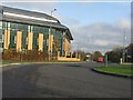
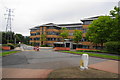
Photos of B90 4LZ


Area Information
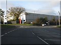
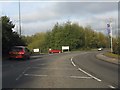
B90 4LZ sits within the Shirley South electoral ward in the Metropolitan Borough of Solihull. This specific postcode covers a small residential cluster spanning just 1590 square metres. It represents a dense lived-in environment where 1730 people call this stretch of urban suburb home. Historically, Shirley began as a rural settlement in Warwickshire before transforming into a prominent residential area driven by industrial growth and the Lucas factory. Today, the ward functions as a significant commercial hub with a high proportion of workplace jobs relative to the resident working-age population. Prospective buyers looking for privacy in a traditional sense may find the sheer population density notable. The postcode code itself marks a specific residential node within a larger district that has evolved significantly since the Iron Age hill forts at Berry Mound. Living here means embracing an urban residential setting where history intersects with modern distribution centres and retail parks. The area is bisected by Stratford Road, a historic turnpike that currently serves the A34 corridor. You will find that daily life in B90 4LZ is characterised by proximity to major employment sites rather than quiet countryside isolation.
- Area Type
- Postcode
- Area Size
- 1590 m²
- Population
- 1730
- Population Density
- 2756 people/km²
The property market in B90 4LZ is overwhelmingly owner-occupied, with 77 per cent of dwellings held by their occupants. The data confirms that houses form the primary accommodation type in this postcode area. This skewed statistics suggest a buyer market where outright purchases or long-term mortgages are the standard rather than the rental sector. You will find few purpose-built flats or blocks of residential flats within the specific cluster of 1590 square metres defined by this postcode. Instead, the housing stock consists largely of detached or semi-detached family homes typical of post-war suburban expansion. The history of the area, including the Lucas factory developments from 1965, points to a era of substantial housing construction designed for permanent residency. This contrasts sharply with the rental-heavy markets often found near university towns or digital hubs. Buying a home in B90 4LZ offers security known as the 77 per cent ownership rate. The local real estate landscape does not cater to short-stay lets or student accommodation. Prospective buyers looking for established neighborhoods with low void periods will find this area suits their needs well. The market dynamics here reflect a desire for ownership stability rather than investment speculation.
House Prices in B90 4LZ
No properties found in this postcode.
Energy Efficiency in B90 4LZ
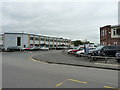
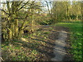
Daily amenities for residents of B90 4LZ are concentrated within the wider Shirley area. Retail options include Co-op Shirley, M&S Sears, and Lidl Sears, providing essential shopping within a short drive. These five retail outlets cover general groceries and clothing needs effectively. Rail connectivity brings five nearby stations including Widney Manor, Solihull, and Shirley to support your daily commute. For longer journeys, Birmingham International Airport and the railway station serve as key transport hubs just two units away in the nearby metro zone. Leisure and green space are anchored by Marshall Lake park and retail centre, a notable feature for the area. Sharmans Cross Senior School also marks the location of former civic features like the Odeon Cinema. The historic Shirley Street offers character with sites like the former Red Lion and Saracens Head inns. The Shirley Golf Club occupies the site of a former racecourse, adding recreational space. You can walk to St James' Church, built in 1832, for community events or quiet reflection. The network of five shops and five rail stations ensures no long journeys for daily essentials.
Amenities
Schools
Families living in B90 4LZ have access to a specific selection of state-funded education options nearby. Cranmore Infant School serves the younger cohort with a 'good' Ofsted rating. It operates as a primary school for early years education. Wider Junior School, also rated 'good' by Ofsted, caters to children advancing through the primary school next door. This pairing provides a continuous primary education experience within a single community setting. The area also includes Solihull Alternative Provision Academy, which fulfills an 'other' school type role. This institution supports specific educational needs outside the standard mainstream primary flow. You will find no comprehensive academies or secondary schools explicitly listed within the immediate vicinity of this particular postcode. The school mix indicates a reliance on primary education locally, with older children likely travelling to facilities further away. The presence of two 'good' rated primary institutions suggests a functional local education system for families with younger children. Access to these schools means reduced travel times for early education. The availability of an alternative provision academy adds educational support resources for the broader Solihull catchment area.
| Rank | School | Type | Entry gender | Ages |
|---|
Explore more schools in this area
Go to Schools tabDemographics
The community in B90 4LZ is defined by a mature and established population profile. The median age stands at 47, with adults between 30 and 64 years forming the most common age range. This demographic structure suggests a neighbourhood dominated by family households and couples rather than young professionals or retirees. Home ownership is exceptionally high, with 77 per cent of residents owning their properties outright or with a mortgage. This indicates a stable environment where long-term residents have settled into the community. The predominant ethnic group is White, reflecting the historical development patterns of Solihull as a suburb that expanded during the mid-20th century. Accommodation types are primarily houses, distinguishing this area from the council estates or high-rise flats found in other parts of the West Midlands. The high ownership rate implies lower tenant turnover and a sense of permanence among neighbours. You can expect a residential character where families have deep roots in the ward rather than a transient population looking for short-term lets. This demographic consistency often translates to cohesive local institutions and active community groups.
Household Size
Accommodation Type
Tenure
Ethnic Group
Religion
Household Composition
Age
Household Deprivation
NS-SEC
Explore more demographic insights in this area
Go to Demographics tabPlanning
Planning Constraints
- Flood RiskPremium
- Ramsar Wetland SitesPremium
- Area of Outstanding Natural BeautyPremium
- Protected Nature ReservePremium
- Protected WoodlandPremium