Area Overview for B90 4LR
Photos of B90 4LR


Area Information
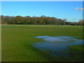
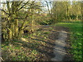
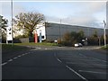
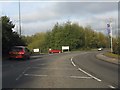
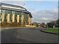
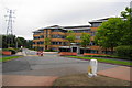
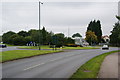
Living in B90 4LR means inhabiting a small, tightly knit residential cluster within the Shirley area of Solihull, West Midlands. With a population of 1,730, this postcode reflects a suburb that has evolved from a historic rural settlement into a modern urban community. Situated along Stratford Road, a key artery bisecting the area, B90 4LR balances residential tranquillity with proximity to commercial and industrial hubs. The area’s character is shaped by its history as part of Solihull’s largest districts, where development from the 1920s onwards introduced schools, retail, and housing estates. Today, it serves as a practical base for commuters, with rail links and proximity to Birmingham International Airport. The mix of office spaces, retail, and residential properties suggests a community where work and home life coexist, though the area’s smaller size means residents often look to nearby wards for broader amenities. For those seeking a stable, low-risk environment with access to essential services, B90 4LR offers a straightforward, no-frills lifestyle.
- Area Type
- Postcode
- Area Size
- Not available
- Population
- 1730
- Population Density
- 2756 people/km²
The property market in B90 4LR is characterised by a high rate of home ownership (77%) and a focus on houses rather than flats or apartments. This suggests a community of long-term residents who have invested in their properties, likely prioritising stability over rental flexibility. The predominance of houses indicates a more traditional housing stock, which may appeal to families or those seeking larger living spaces. However, the small size of the area means the housing stock is limited, and buyers may need to consider nearby wards for more options. The lack of rental properties implies a lower turnover of homes, which could be a consideration for those seeking short-term or flexible housing. For buyers, this area offers a straightforward market with established properties, though the absence of newer developments may mean fewer modern amenities.
House Prices in B90 4LR
Showing 1 properties
| Address | Type | Beds | Baths | Last Sale Price | Last Sale Date | |
|---|---|---|---|---|---|---|
| Uk Plumbing Supplies Ltd, Shire House, Highlands Road, Shirley, Solihull, B90 4LR | storage_distribution | - | - | - | - |
Energy Efficiency in B90 4LR
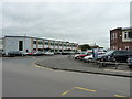
Residents of B90 4LR have access to a range of retail and transport hubs within practical reach. Five retail outlets, including Co-op Shirley, M&S Sears, and Lidl Sears, provide everyday shopping options. The area’s rail network is extensive, with five stations offering connections to Solihull, Birmingham, and surrounding regions. Proximity to Birmingham International Airport and the Birmingham Intl Railway Station enhances travel flexibility, particularly for those working in or visiting the city. While the area lacks large parks or leisure facilities, its integration into Solihull’s broader network means residents can access Marshall Lake park and other amenities nearby. The mix of retail, rail, and airport access creates a convenient lifestyle, though the small postcode size means some leisure activities require a short journey. The presence of multiple shops and transport links supports a practical, community-focused daily life.
Amenities
Schools
Residents of B90 4LR have access to two primary schools with good Ofsted ratings: Cranmore Infant School and Widney Junior School. These institutions provide a solid foundation for early education, though the area lacks secondary schools, requiring students to travel to nearby wards. The presence of Solihull Alternative Provision Academy, which serves as an ‘other’ school type, suggests additional support for students with specific educational needs. The mix of primary schools with strong ratings is a positive for families, but the absence of local secondary education may impact convenience. Parents should consider the broader Solihull network for secondary schooling, as the area’s small size limits local options. The good Ofsted ratings indicate reliable standards, but families may need to plan for longer commutes to access a full range of educational stages.
| Rank | School | Type | Entry gender | Ages |
|---|
Explore more schools in this area
Go to Schools tabDemographics
The demographic profile of B90 4LR is defined by a median age of 47, with the majority of residents falling within the 30-64 age range. This suggests a community of established adults, many of whom are likely in their prime working years or nearing retirement. Home ownership is high, at 77%, indicating a stable population with long-term ties to the area. The predominant accommodation type is houses, which aligns with the higher proportion of owner-occupied properties. The predominant ethnic group is White, though no specific data on diversity or deprivation is provided. The age distribution implies a family-friendly environment, though the absence of younger residents may limit local schools’ pupil numbers. The relatively low population size of 1,730 means the area is compact, fostering a close-knit community but potentially limiting the range of services available without venturing beyond the postcode.
Household Size
Accommodation Type
Tenure
Ethnic Group
Religion
Household Composition
Age
Household Deprivation
NS-SEC
Explore more demographic insights in this area
Go to Demographics tabPlanning
Planning Constraints
- Flood RiskPremium
- Ramsar Wetland SitesPremium
- Area of Outstanding Natural BeautyPremium
- Protected Nature ReservePremium
- Protected WoodlandPremium