Area Overview for B90 4LL
Photos of B90 4LL
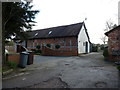

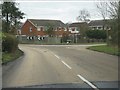
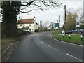
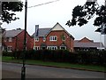
16 photos from this area
Area Information
Key information about the B90 4LL including its size, population, and administrative classification.
- Area Type
- Postcode
- Area Size
- 4152 m²
- Population
- 1503
- Population Density
- 2033 people/km²
House Prices in B90 4LL
19
Properties
£300,771
Average Sold Price
£198,508
Lowest Price
£462,500
Highest Price
Showing 19 properties
| Address | Type | Beds | Baths | Last Sale Price | Last Sale Date | |
|---|---|---|---|---|---|---|
| 19 Mount Dairy Farm Lane, Cheswick Green, Solihull, B90 4LL | Terraced | 2 | 3 | £320,000 | Nov 2025 | |
| 2 Mount Dairy Farm Lane, Cheswick Green, Solihull, B90 4LL | Semi-detached | 2 | 2 | £303,000 | May 2025 | |
| 5 Mount Dairy Farm Lane, Cheswick Green, Solihull, B90 4LL | Retail | 2 | 2 | £320,000 | Aug 2024 | |
| 3 Mount Dairy Farm Lane, Cheswick Green, Solihull, B90 4LL | Semi-detached | 2 | 2 | £310,000 | Apr 2024 | |
| 17 Mount Dairy Farm Lane, Cheswick Green, Solihull, B90 4LL | Terraced | 2 | 3 | £289,950 | Nov 2019 | |
| 18 Mount Dairy Farm Lane, Cheswick Green, Solihull, B90 4LL | Semi-detached | 2 | 2 | £279,950 | Nov 2019 | |
| 4 Mount Dairy Farm Lane, Cheswick Green, Solihull, B90 4LL | house | - | - | £297,950 | Oct 2019 | |
| 11 Mount Dairy Farm Lane, Cheswick Green, Solihull, B90 4LL | house | - | - | £198,508 | Oct 2019 | |
| 14 Mount Dairy Farm Lane, Cheswick Green, Solihull, B90 4LL | house | - | - | £268,931 | Oct 2019 | |
| 12 Mount Dairy Farm Lane, Cheswick Green, Solihull, B90 4LL | house | - | - | £198,508 | Oct 2019 |
Page 1 of 2
Energy Efficiency in B90 4LL
Amenities
Schools
| Rank | School | Type | Entry gender | Ages |
|---|
Explore more schools in this area
Go to Schools tabDemographics
Household Size
Family (3-5 people)
most common
Accommodation Type
Houses
most common
Tenure
85
majority
Ethnic Group
White
most common
Religion
N/A
most common
Household Composition
N/A
most common
Age
47
median
Adults (30-64 years)
most common
Household Deprivation
N/A
with no deprivation
NS-SEC
45
in Lower managerial occupations
Explore more demographic insights in this area
Go to Demographics tabPlanning
Planning Constraints
- Flood RiskPremium
- Ramsar Wetland SitesPremium
- Area of Outstanding Natural BeautyPremium
- Protected Nature ReservePremium
- Protected WoodlandPremium