Area Overview for B90 4JE
Photos of B90 4JE
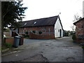


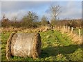
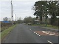
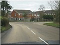
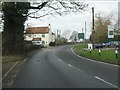
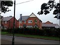
16 photos from this area
Area Information
Key information about the B90 4JE including its size, population, and administrative classification.
- Area Type
- Postcode
- Area Size
- 17.4 hectares
- Population
- 1503
- Population Density
- 2033 people/km²
House Prices in B90 4JE
29
Properties
£425,468
Average Sold Price
£210,000
Lowest Price
£1,100,000
Highest Price
Showing 29 properties
| Address | Type | Beds | Baths | Last Sale Price | Last Sale Date | |
|---|---|---|---|---|---|---|
| 577 Tanworth Lane, Cheswick Green, Solihull, B90 4JE | Detached | 4 | 2 | £657,000 | Sep 2024 | |
| 574 Tanworth Lane, Cheswick Green, Solihull, B90 4JE | Cottage | 2 | 1 | £380,000 | Apr 2023 | |
| 561 Tanworth Lane, Cheswick Green, Solihull, B90 4JE | house | - | - | £1,100,000 | Apr 2022 | |
| 581 Tanworth Lane, Cheswick Green, Solihull, B90 4JE | Detached | 5 | 2 | £599,950 | Jun 2021 | |
| Voice Fostering Ltd, 595 Tanworth Lane, Cheswick Green, Solihull, B90 4JE | Bungalow | 4 | 2 | £525,000 | Mar 2020 | |
| 587 Tanworth Lane, Cheswick Green, Solihull, B90 4JE | house | 5 | - | £517,500 | Feb 2018 | |
| Bramley Cottage, 553 Tanworth Lane, Cheswick Green, Solihull, B90 4JE | house | 2 | - | £296,000 | Jul 2017 | |
| Elder Cottage, 557 Tanworth Lane, Cheswick Green, Solihull, B90 4JE | Semi-detached | 3 | 2 | £470,000 | Jan 2017 | |
| Jasmin Cottage, 553B Tanworth Lane, Shirley, Solihull, B90 4JE | Semi-detached | 2 | 1 | £285,000 | Apr 2016 | |
| 575A Tanworth Lane, Cheswick Green, Solihull, B90 4JE | house | 4 | - | £358,000 | Sep 2013 |
Page 1 of 3
Energy Efficiency in B90 4JE
Amenities
Schools
| Rank | School | Type | Entry gender | Ages |
|---|
Explore more schools in this area
Go to Schools tabDemographics
Household Size
Family (3-5 people)
most common
Accommodation Type
Houses
most common
Tenure
85
majority
Ethnic Group
White
most common
Religion
N/A
most common
Household Composition
N/A
most common
Age
47
median
Adults (30-64 years)
most common
Household Deprivation
N/A
with no deprivation
NS-SEC
45
in Lower managerial occupations
Explore more demographic insights in this area
Go to Demographics tabPlanning
Planning Constraints
- Flood RiskPremium
- Ramsar Wetland SitesPremium
- Area of Outstanding Natural BeautyPremium
- Protected Nature ReservePremium
- Protected WoodlandPremium