Area Overview for B90 3SH
Photos of B90 3SH


Area Information
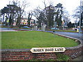
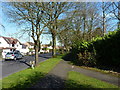
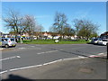
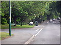
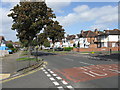
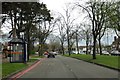
B90 3SH, a small residential postcode in England, lies within the suburban village of Olton, part of Solihull’s Metropolitan Borough. With a population of 1,685, it retains the character of an independent village despite its proximity to Solihull. Historically rooted, Olton’s name derives from its origins as the site of the manor of Ulverlei, founded by Wulfhere, the first Christian king of Mercia. The area transitioned from agricultural land to a residential community after the railway station opened in 1869, fostering a quiet, suburban atmosphere. Today, B90 3SH offers a blend of historic charm and modern convenience. Residents benefit from nearby railway connections, including Yardley Wood and Hall Green stations, and proximity to Birmingham International Airport. Olton Mere, a significant reservoir and recreational space, adds to the area’s appeal. The postcode’s compact size means daily life is centred around local amenities, family-oriented living, and a sense of community. For those seeking a balance between rural tranquillity and urban accessibility, B90 3SH presents a distinctive opportunity.
- Area Type
- Postcode
- Area Size
- Not available
- Population
- 1685
- Population Density
- 4044 people/km²
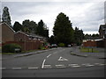
The property market in B90 3SH is dominated by owner-occupied homes, with 77% of residents living in their own houses. This high home ownership rate suggests a community of long-term residents who view property as a stable asset. The accommodation type is primarily houses, which is typical of suburban areas and indicates a preference for private, family-friendly living spaces. Given the small size of the postcode, the housing stock is limited, meaning buyers may need to consider nearby areas for a broader selection. The predominance of houses also implies that the market caters to those seeking larger properties, potentially appealing to families or individuals prioritising space and privacy. For buyers, this suggests a focus on quality over quantity, with properties likely retaining value due to the area’s low crime risk and historical appeal.
House Prices in B90 3SH
No properties found in this postcode.
Energy Efficiency in B90 3SH
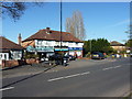
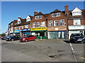
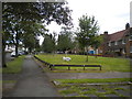
Living in B90 3SH provides access to a range of practical amenities within easy reach. Retail options include Tesco Hall, Co-op Northfield, and Aldi Hall, offering everyday shopping convenience. The area’s rail network, with stations like Yardley Wood and Hall Green, connects residents to nearby cities and transport hubs, while proximity to Birmingham International Airport and metro stations like Grand Central New Street adds to its accessibility. Historically significant sites such as Olton Mere, a reservoir and recreational lake, and St Margaret’s Church, a Grade II listed building, contribute to the area’s character. The presence of Olton Friary, once a Catholic seminary, adds cultural depth. These amenities blend practicality with heritage, offering residents a mix of modern convenience and historical richness that enhances daily life.
Amenities
Schools
| Rank | School | Type | Entry gender | Ages |
|---|
Explore more schools in this area
Go to Schools tabDemographics
The community in B90 3SH is predominantly composed of adults aged 30–64, with a median age of 47. This suggests a mature, stable population, likely with established careers and families. Home ownership is high at 77%, indicating a strong presence of long-term residents and a focus on property as a long-term investment. The accommodation type is primarily houses, reflecting a suburban layout with private, family-oriented living spaces. The predominant ethnic group is White, which aligns with the broader demographic trends in the West Midlands. While no specific data on deprivation is provided, the high home ownership rate and low crime risk (Safety Score: 73/100) imply a relatively affluent and secure environment. This profile suggests a community prioritising stability, with residents likely valuing the area’s historical character and practical connectivity to nearby cities.
Household Size
Accommodation Type
Tenure
Ethnic Group
Religion
Household Composition
Age
Household Deprivation
NS-SEC
Explore more demographic insights in this area
Go to Demographics tabPlanning
Planning Constraints
- Flood RiskPremium
- Ramsar Wetland SitesPremium
- Area of Outstanding Natural BeautyPremium
- Protected Nature ReservePremium
- Protected WoodlandPremium